12th – 20th March 2022
Torres del Paine National Park, with its towering peaks and stunning scenery is one of the most iconic hiking areas in South America and arguably the world. Its two flag-ship multi-day hiking routes, the W- and O-Treks, are world famous and are on many a hiker’s bucket list. Years ago, when I was just a ‘Brit Abroad’ I was lucky enough to hike the W-Trek with some friends and was blown away by the beauty of the place. So, when we got the green light to enter Chile during our year travelling, hiking the O-Trek was probably top of my list in terms of activities I wanted to do. Despite it being quite late in the season, we were fortunate enough to be able to achieve this goal, so if you wish to find out more about our trek, then please read on…
Contents
- Why hike the O-Trek?
- Booking the O-Trek
- Our experiences booking the O-trek
- How to get to Torres del Paine National Park
- Our time on the O-Trek
- Day 1 – Arriving at the park and walking to Camp Serón
- Day 2 – Camps Serón to Dickson
- Day 3 – Camps Dickson to Los Perros
- Day 4 – Camps Los Perrso to Grey, via the John Garner Pass
- Day 5 – Camps Grey to Paine Grande
- Day 6 – Camps Paine Grande to Frances
- Day 7 – Camps Frances to Los Cuernos, via the Frances and Britanico Viewpoints
- Day 8 – Camps Los Cuernos to Chileno
- Day 9 – Camp Chileno to the Endpoint, via the Towers
- Final Thoughts
Why hike the O-Trek?
I guess this question can be broken up into two parts. First, should you go hiking in Patagonia? And the second question is whether you should hike the W-Trek or the O-Trek?
The first question is easy, the answer is yes. If you love hiking and are lucky enough to get a chance to go hiking in Patagonia, then you definitely should. It is just stunning and has a rugged charm and beauty that stands up against anywhere we’ve been in the world. And whilst Patagonia has many amazing sites for hiking on both the Argentinian and Chilean sides of the Andes, there is a reason that Torres del Paine National Park has become so popular. Its mix of outstanding natural beauty and reasonable infrastructure has meant that it is an accessible option for a multitude of hikers. You may not have the time, equipment or experience to tackle a hike such as the Huemul Circuit or the Sierra Valdivieso Circuit further south in Ushuaia, but the infrastructure and ability to sort and book from a distance, allows more hikers to access Torres del Paine National Park, despite the hikes themselves still being challenging.
The second question is more tricky and depends on your particular situation. There are plenty of blogs detailing the differences between the two, but I’ll give a brief comparison here.
The W-Trek is shorter, taking about 4-5 days on average to cover 80km, and there are greater options in terms of campsites and the way in which you can tackle the hike. Most of the major sights, such as Grey Glacier, the Britanico viewpoint and the Towers themselves are still included on the W-Trek and yet it is still seen as the ‘easier’ of the two hikes. Those who are restricted by time or for whom seeing the major sights is the major purpose for visiting the area, are much more likely to be attracted to the W-Trek. It is also a more manageable hike for those who might not have the experience of challenging multi-day hikes.
The O-Trek is the longer of the two, covering 120km over 8-10 days on average. Whilst the W-Trek starts at one side of the park and finishes at the other (in the shape of a W, hence the name); the O-Trek is a complete loop (hence the ‘O’) and, as well as the length of the W-Trek, there are a few days away from the crowds around the opposite side of the main peaks. Leaving the crowds tackling the W-Trek (and also the day-trippers) is one of the major draws for hiking the O-Trek, as you feel much more isolated and have the space to properly appreciate the nature around you. However, adding the extra distance is difficult enough and the campsites accessed only on the O-Trek are more basic than those that you stay at on the W-Trek. There is also the lack of flexibility in terms of the route you take, as you can only attempt it in the anti-clockwise direction. Plus, you have to climb the infamous John Garner Pass. The steep climb and then descent from the pass is part of the longest and toughest day tacking the circuit. The pass is also notorious for its unstable weather. So taking on the circuit should not be taken lightly.
We really wanted to hike in Torres del Paine National Park but there was quite an in-depth debate about which of the hikes we should attempt. Given that I had previously hiked the W-Trek, I was quite keen to try the O Circuit but we were worried about our ability to manage it. In the end, our adventurous curiosity got the better of us and we committed to the O. But the doubt still lingered, and that was the main reason that we put aside our ‘hiking pride’ and booked the tents at the campsites rather than carrying them with us. We were pretty sure we could handle the distance but we weren’t sure we were in good enough shape to do it whilst also lugging around the extra weight of the camping equipment. In the end, it was a good decision, as it was tough enough without the extra weight and we met hikers who were really struggling and were regretting their own decision to do it in that way. I’m really not sure how much we would have enjoyed it if we’d ‘done it properly’ and taken all of our own stuff. But we are very glad that we did attempt it in some way, as it is a fabulous hike.
Booking the O-Trek
I’m not going to sugar-coat it, booking the O-Trek is an absolute pain in the backside. We were booking it during COVID and towards the end of the season and yet we still couldn’t get exactly what we wanted during the times we were aiming for. I cannot comprehend how difficult it might be under normal circumstances in peak season! So, book it as far in advance as possible.
There are several things you need to consider:
- Booking the campsites (this has to be done in advance – you can’t just rock up).
- Deciding on options regarding camping equipment and food schedules.
- Booking the National Park entry permit.
- Sorting transport to and from the park.
All of the these things need to be done in advance. As you go tick them off, make sure you have offline copies of the confirmations, as you will need them. Personally, as well as offline electronic copies, I’d print off physical paper copies as well, just in case.
Once you have made a plan for your route, you can start trying to book your campsites. For these, you very frustratingly need to book through two separate companies, as they each own some of the campsites.
For Central, Chileno, Cuernos, Francés and Serón Camps, you need to book through Las Torres. The site also has a hotel and some cabins in the park, but we didn’t try any of these to be able to comment.
For Dickson, Los Perros, Grey, and Paine Grande, you need to book with Vertice Patagonia.
The websites are not great (although they have improved since I first used them about ten years ago) and having to confirm specific options on both websites at the same time can be torturous. But it needs to be done.
For each campsite you also need to consider what options you want. Firstly, think about whether you want the option of the tent and sleeping bag sorted for you when you arrive, or whether you want to carry your own. As already mentioned, we went with the option that included the equipment. And even though it is expensive, we are very glad that we did. The gear was of good quality and it was great not having to carry the weight for the whole trek.
You also need to consider whether you want to have food at the campsites. The meals are certainly overpriced, but the food is generally very good and it is really nice to have a warm meal after a day on the trail. To try and save a bit of money, we carried food for breakfasts but booked evening meals at most of the campsites. If you haven’t booked a meal, you can always ask when you arrive at the campsite, but there’s no guarantee that they’ll be able to fit you in. Please also be aware that Los Perros doesn’t provide the option of food, so you do need to carry at least some. We countered that by having a full breakfast at Lago Dickson before hiking on towards Los Perros. We felt a bit like frauds for having proper cooked meals on the trail but that slight embarrassment was certainly overcome by our appreciation of the hot meals after hiking and not having to purchase and carry all of the necessary cooking equipment.
In terms of the permit for the National Park, it can be purchased in advance from the official website.
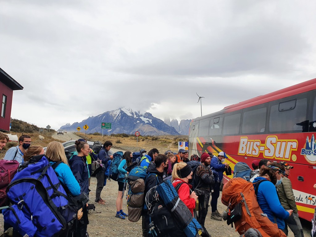
Lastly, do not forget to book your buses to and from the park. Whilst there are several during the day, the ones earlier in the morning, which are better for a prompt start to the walk, sell out quite fast. For the day in which you complete the trek, it is a bit weird having such a fixed time by which you need to be at the exit, but it again needs to be done, so try and give yourself more time than you probably need. If you are early, it just means you can appreciate the views of the towers for a bit longer and congratulate yourself on a job well done. The bus company we used was Bus Sur. The bus was good and everything was on time. We were also right at the front of the bus on the journey there and the bus driver paused briefly when he saw us trying to take photos as we approached the entrance to the park.
Our experiences booking the O-trek
It took quite a while to get our permits sorted for entering Chile during our year of travelling, given that it was one of the most strict South American countries regarding entry during the latter stages of COVID. And therefore, when we eventually were able to fly into Santiago, it ended up being a frantic quarantine period as we spent our enforced time in the hotel trying to sort our trip down to Patagonia before it got too late in the year.
The main issue we encountered was trying to book a suitable time to do the O-Trek in Torres del Paine National Park. Given that we were visiting as part of a bigger trip rather than specifically going to do the hike, we weren’t carrying gear such as tents, proper sleeping bags or cooking equipment. Whilst we looked into hiring such equipment just for the trek, it was hard to do so from a distance, and thus we decided to just book spots at the campsites with tents and sleeping bags included. This had the advantage that we would not have to carry so much on our backs during the trek and given that we hadn’t been training for the trek, it seemed like a sensible course of action. The disadvantages, however, were that this made the trip more expensive and we were more restricted in when the campsites were available.
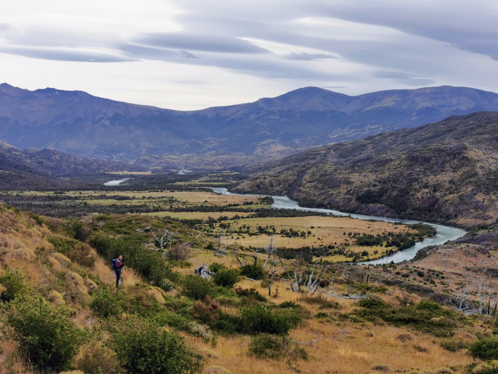
Due to limited spaces at each campsite that provided the tent and sleeping bags, we had to piece together an itinerary that would fit the route for the O-trek. Given that everyone doing the O-Trek had to do so in the same direction, you might think that it would be quite straightforward to book the campsites. But that was far from the truth. There were some campsites closed, and different campsites had different amounts of spaces available. It also became more complicated when the O-Trek joined the campsites that also serviced the W-Trek. So, we ended up planning itineraries and finding that just one night didn’t work and having to start again. To get a route that worked, even though it wouldn’t be our first choice of campsites and number of nights, we had to push back our trip by a couple of weeks. At that time of the year, every week later made it riskier in terms of the weather, but if we wanted to do the O-Trek rather than the W, and to book the spots with the tents and sleeping bags provided, then we didn’t have a choice. It ended up working out quite well. Our weather wasn’t great, but it could have been a lot worse and we still had some great moments during the trek. It also gave us the opportunity to take the Navimag Ferry through the fjords to get to Puerto Natales in the first place. So, in the end it was definitely worth the hassle and stress.
How to get to Torres del Paine National Park
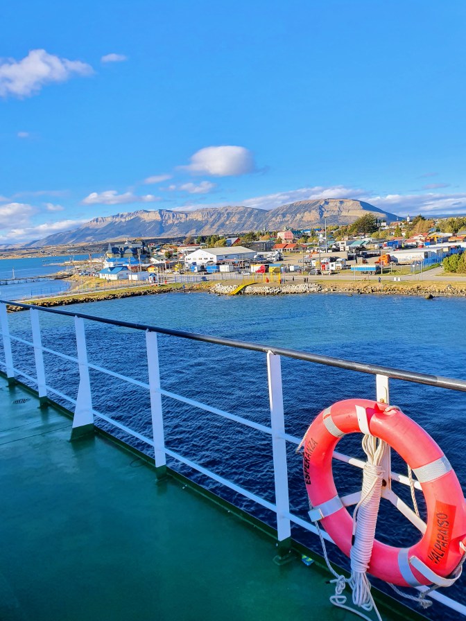
All roads lead to Puerto Natales. Well, I say all roads but it is very possible that you will arrive to this important hub by a different method. Assuming you will enter into Chile via Santiago, then the easiest way to arrive to Patagonia is to fly directly to Puerto Natales. There is also the option of flying to Punta Arenas if you want to explore this area first, and then getting a bus to Puerto Natales prior to heading to Torres del Paine National Park. I’m pretty sure there was also an option of going directly to the National Park straight from Punta Arenas, but it’s a long way and would mean you would only start your hike relatively late in the day. But I guess if you are not starting to hike straight away on your first day, then it could be an option. Also, whilst it was not something we could consider during COVID, there is also a well worn path heading to Puerto Natales from the Argentinian hiking centres of El Chalten and El Calafate. Finally, a slower but very worthwhile route is to take the Navimag Ferry from Puerto Montt through the Patagonian Fjords over several days to get to Puerto Natales. As I’ve already alluded to, this last option is the method by which we arrived to Puerto Natales prior to our trek.
Our time on the O-Trek
Day 1 – Arriving at the park and walking to Camp Serón
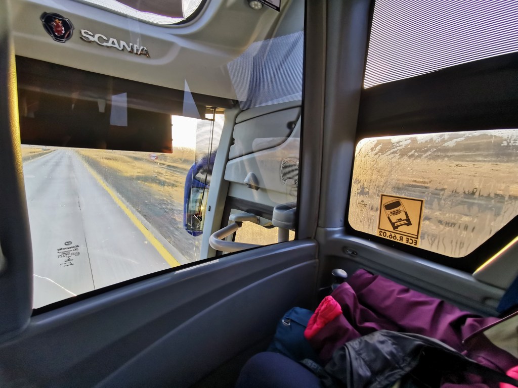
We caught an early bus from the main station in Puerto Natales and by chance, we were sat right at the front. That meant we got great views as the scenery became more remote, before we got our first glimpse of the peaks ahead of us.
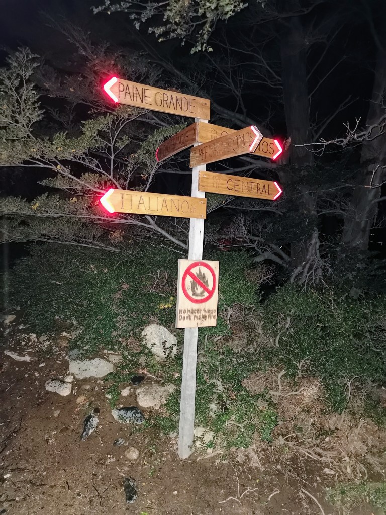
Upon arriving, we had to wait in queues to have our permits checked and to also show that we had accommodation booked for our time in the park. It was useful to have paper copies at this point rather than to have to open up the relevant documents on your phone. After getting through the main building, we were now in the park and ready to start! Despite there being signs, we spend much longer than was really necessary just making sure we were going in the correct direction…
It was at this point, as I slung my large rucksack over my shoulders, that I realised that the buckle on my chest strap was not there. At some point in the transport of the backpack it must have snapped. This was certainly not the way I’d hoped to start the hike…
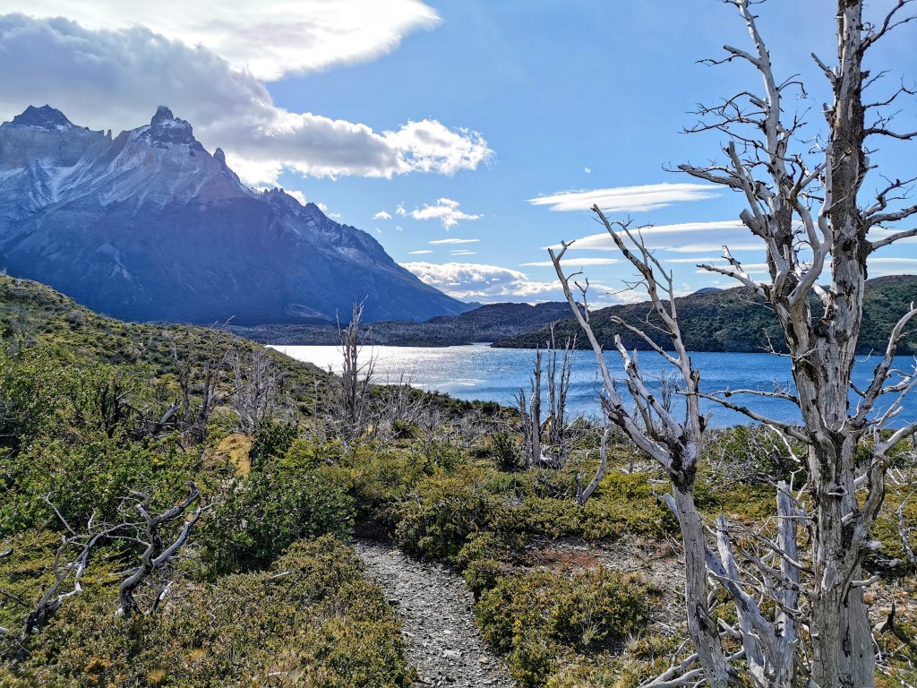
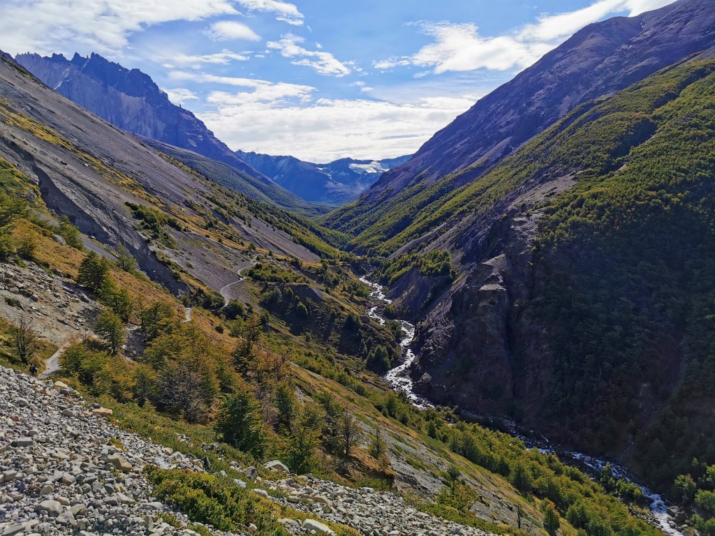
The beginning of the trek is a nice and gentle introduction, as the terrain is quite straightforward and we got to enjoy the weird cloud formations that dotted the sky around us.
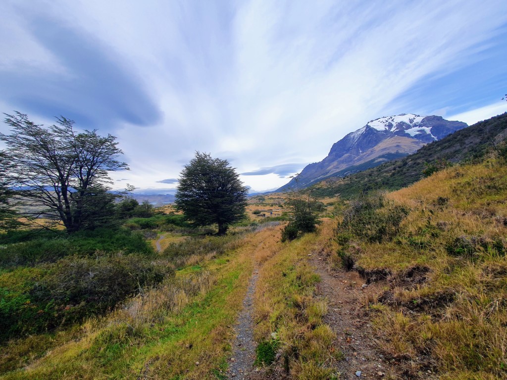
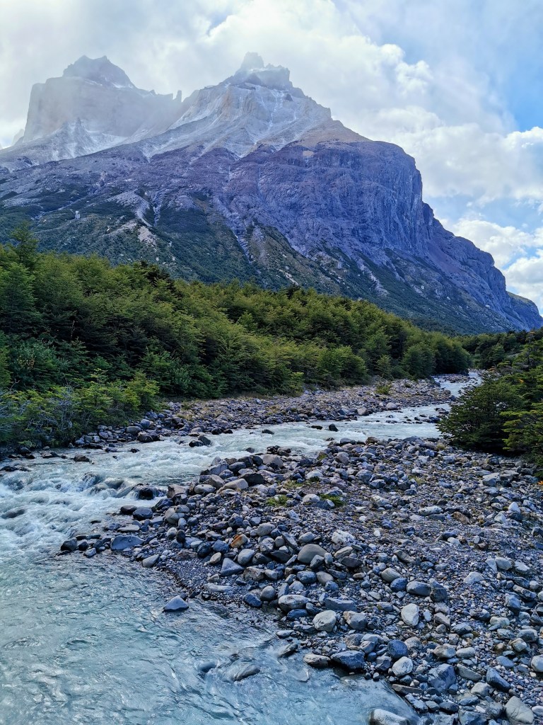
The path carries on into a moss-covered forrest before it opens up and you get a look at the river that you’ll be following for the first day and a bit.
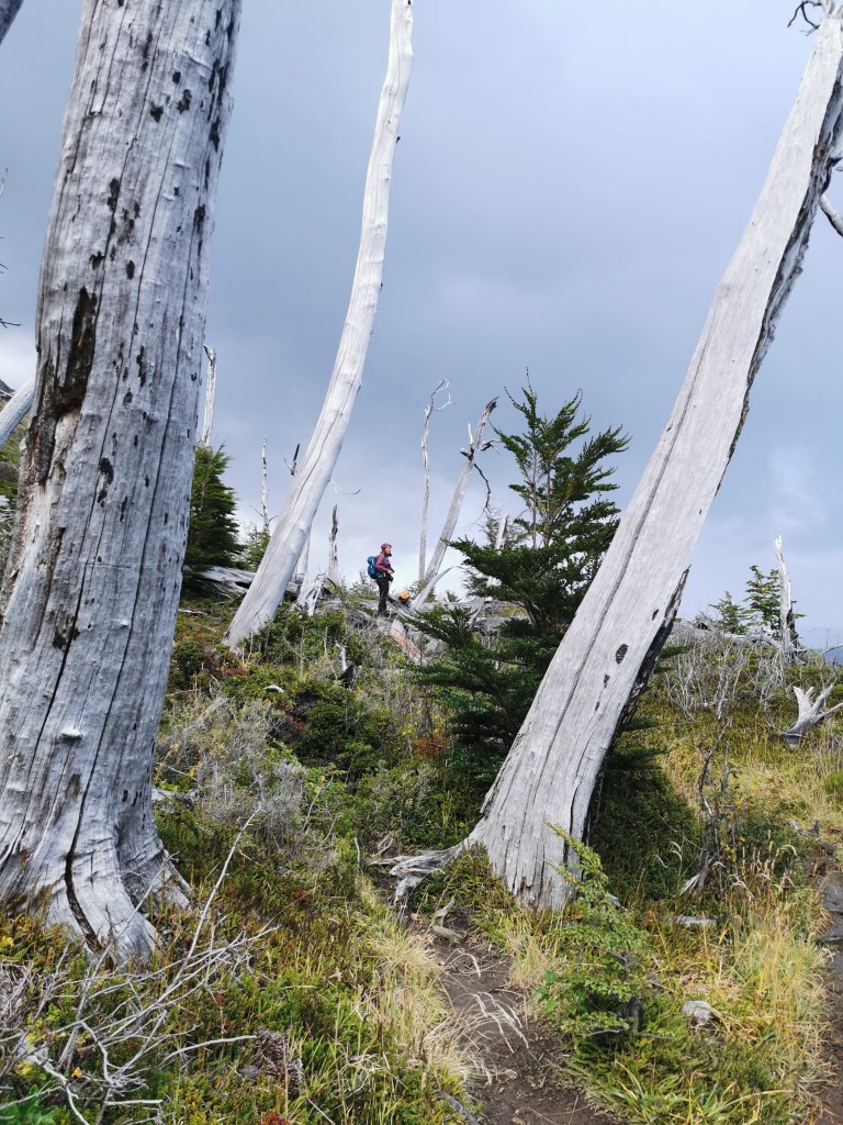
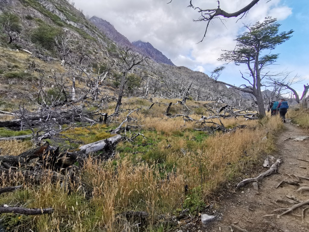
At this point you pass through a section of burnt trees. At the time we thought they looked quite cool and that it added to the dark, desolate atmosphere brought on by the clouds. But given that we kept passing through similar areas over the following week, we soon realised just how much of a problem and how devastating these forest fires could be. It should certainly have acted as a good reminder to anyone who was using a stove or who smoked to take proper care of their fires.
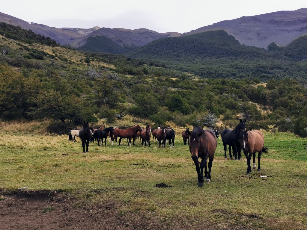
We also passed by a herd of horses, who as soon as we appeared around the corner, started walking over to say hello. As nice as they seemed, we didn’t really want to get stuck in a field with a dozen or so horses, so we quickly made our way over the nearest style.
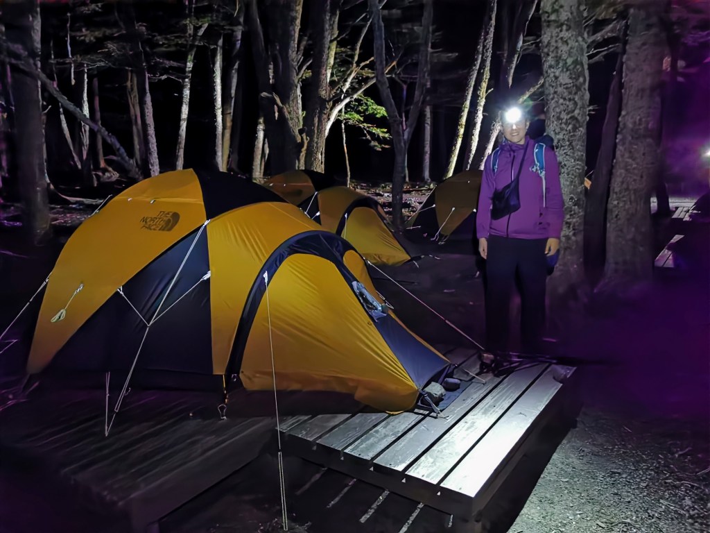
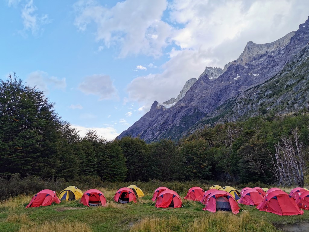
We followed the river for a while until we reached Camp Serón. It had been a fairly easy start to the hike. We had time to relax for a bit before enjoying a very tasty meal of corn soup, salmon and spaghetti, and Calafate ice-cream. We also met for the first time the people who would be our companions over the next week or so. Given that everyone hiking the O-Trek had to go in the same direction, you ended up staying in the same camps, at least until you reached the W-Trek section of the hike, where there was slightly more flexibility in how to space out the journey. One of the couples we met happened to be from the Czech Republic and Slovakia, so Radka delighted in being able to speak her own language to people after having had several months of just English and Spanish, apart from calls home.
The wind that would dog us for the majority of the hike sprang up during the evening and night, but despite the flapping of the sides of the tent, the excitement of the day and the fresh air meant we easily managed to get to sleep.
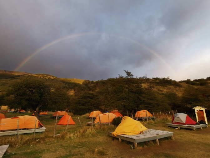
Day 2 – Camps Serón to Dickson
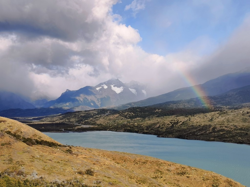
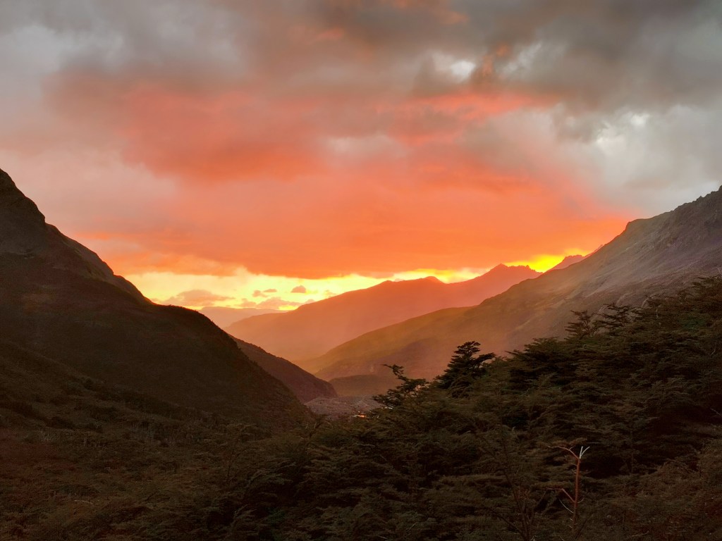
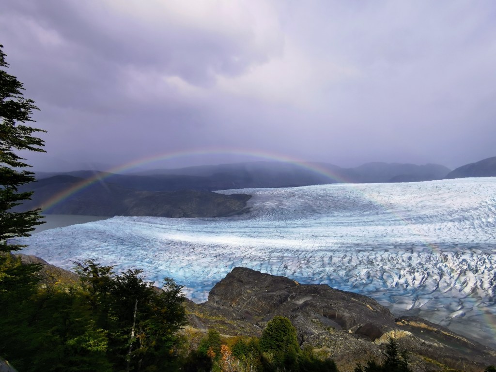
An early start meant we were up to enjoy the pretty dawn colours. After managing to buy some yogurt from the office to supplement our breakfast, we made ready to leave. We were even seen off by a pretty rainbow appearing in a crescent over the tents. As I mentioned during my post about our ferry ride through the fjords, we saw so many amazing rainbows during our time in Patagonia. But maybe that just emphasises how much rain we had…
I’m complaining about the weather, but it wasn’t actually that bad on this day. It was just a bit weird. We seemed to constantly be at the edge of the advancing cloud. It would drizzle for a bit then stop, before starting again ten minutes later.
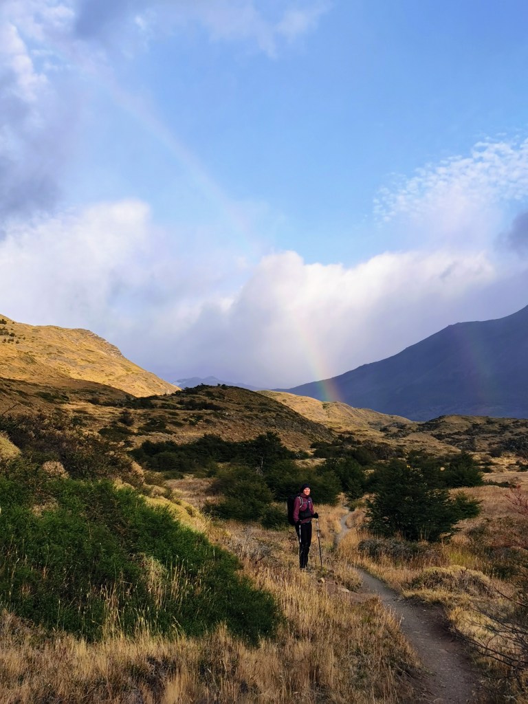
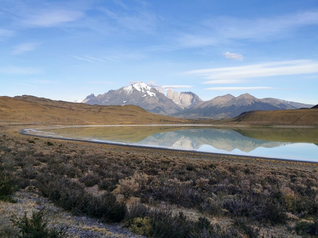
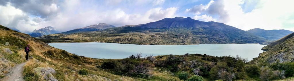
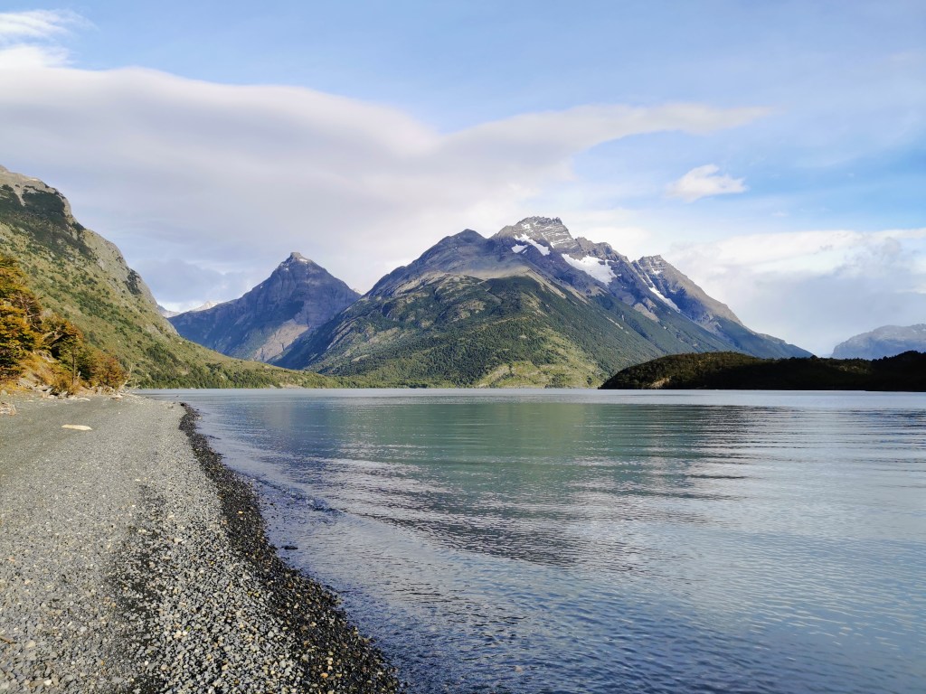
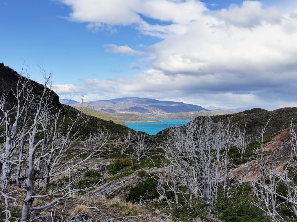
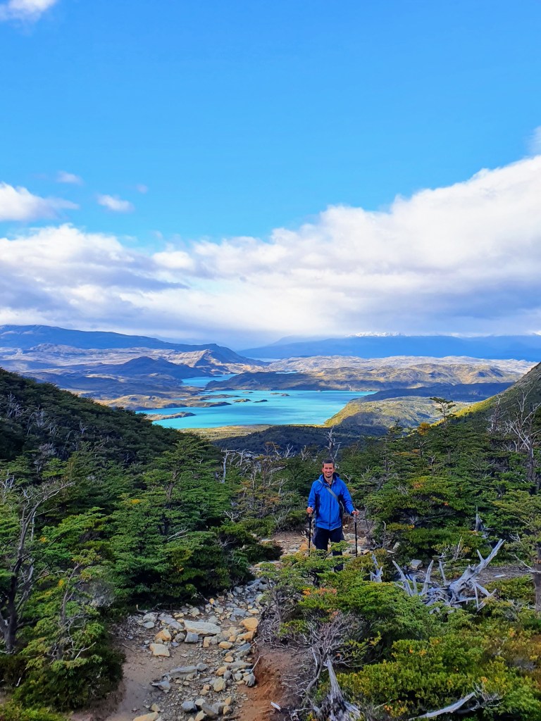
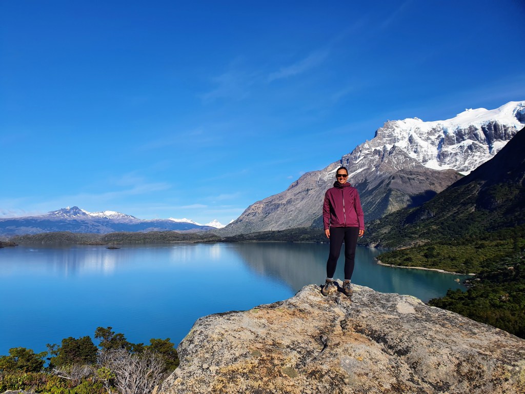
We continued roughly north, loosely following the path of the river. The water really was a beautiful colour as it meandered through the grasslands and shrubbery. We then reached our first bit of ascent, but it was only really a small introduction to what was to come… This ascent was certainly worth it though.

The sudden view over Lago Paine was our first real ‘wow moment’ of the trek. The glacial blue water of the lake was ringed with snow-capped peaks nestled in the clouds. There was even a rainbow to add an extra dimension to the view. However, the sudden appearance at the viewpoint also meant that we were instantly exposed to the full force of the wind. So whilst the view was stunning, we didn’t stop for that long before carrying on our way.
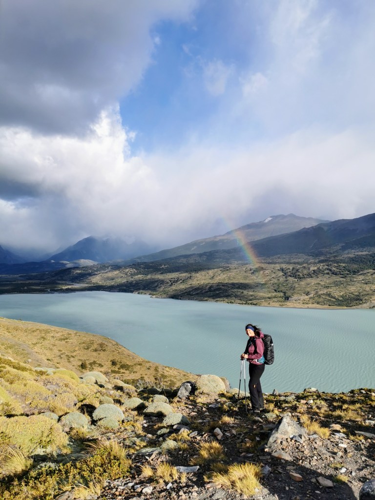
The path ran parallel to the edge of the lake but remained high enough to maintain the beautiful views. And then once the lake ended, we were back to following the Rio Paine.
The walk along the river was very picturesque, and the cloud on the mountains seemed to clear a bit as we approached. We were walking towards the higher peaks that we’d first glimpsed from the viewpoint, so they became more prominent in our line of vision as we walked along the trail. At one point it looked like there was a large cloud sitting in between two mountains, but once some sunlight started to shine on it, it took on a blueish hue, and we realised that we were looking upon a large mountain glacier in the distance.
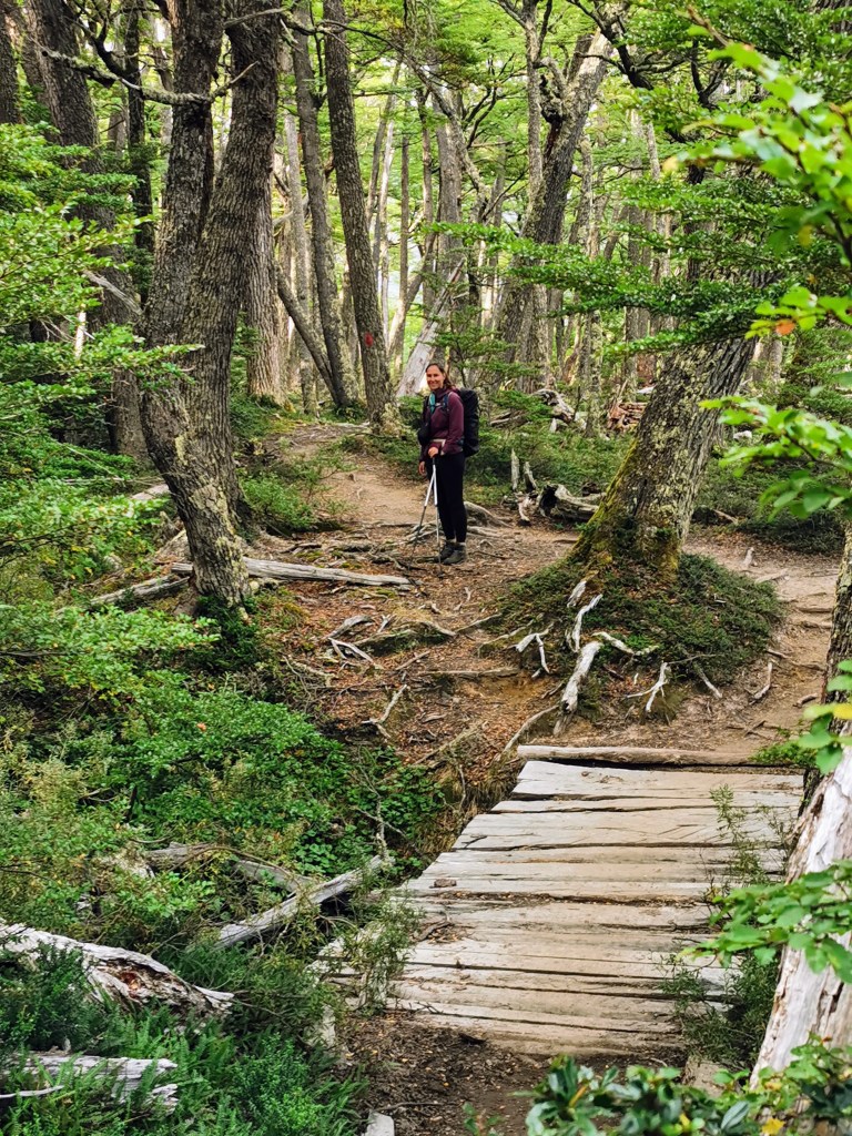
The pathway was quite varied and at one point turned into a boardwalk to protect the vegetation below (and probably to make the going easier).

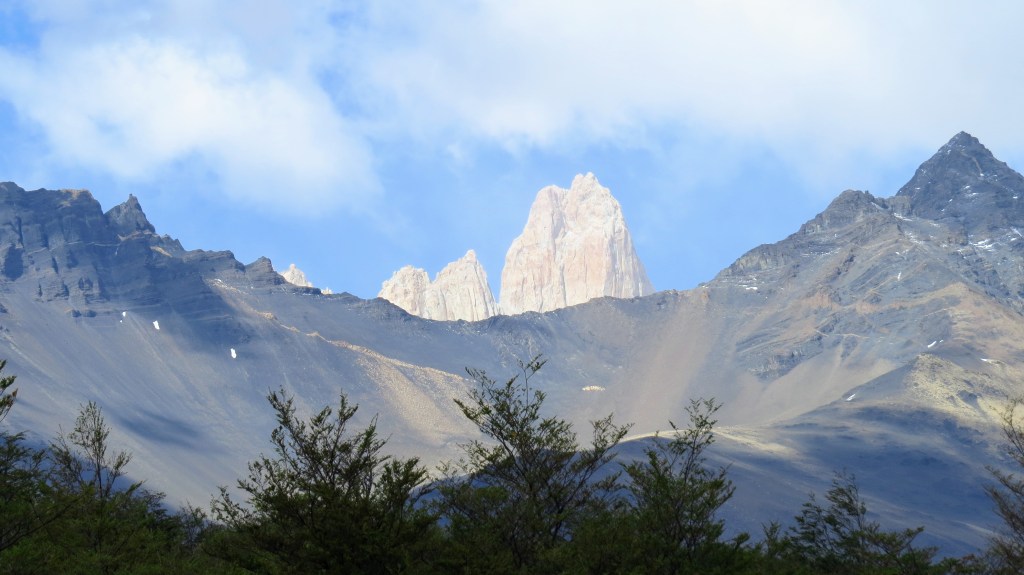
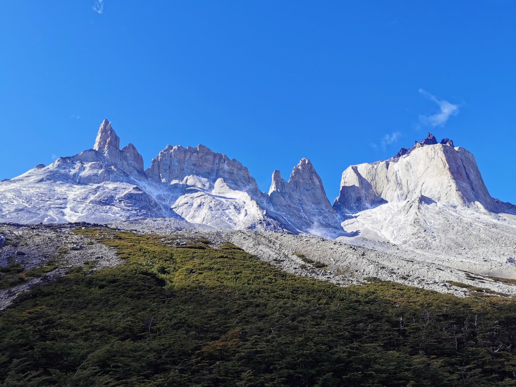
We even got a glimpse of the Towers sticking up over the ridge-line on our left. It would be quite a few days before we’d see them again.
The conditions whilst walking by the river were quite strange in that when the Sun poked its head out from behind the clouds, it got pretty warm, but when it was hidden we were just left with the icy biting wind. And it was almost constantly oscillating between the two, so we had no idea what we should be wearing.
As we neared the end of the river (well technically the start of the river but you know what I mean) there was another ascent and the stunning viewpoint at the top gave us our first glimpse of where we’d spend the night at Camp Dickson.
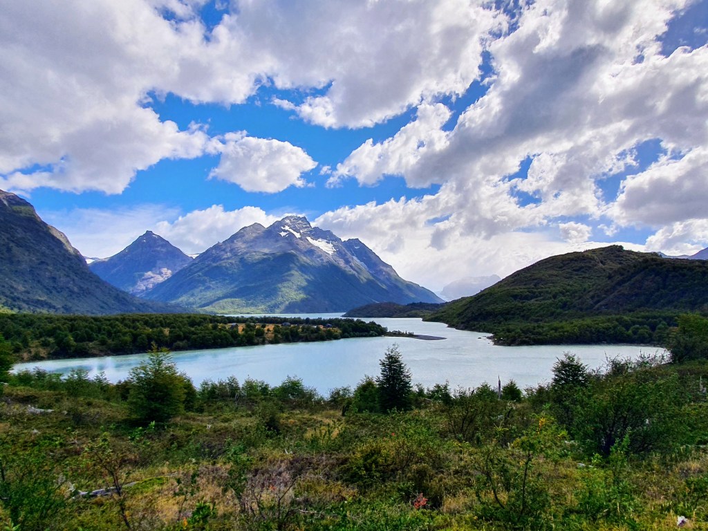
Knowing that we were so close actually made the last little stretch feel quite difficult! But our suddenly tired limbs managed to make our way down to the edge of Lago Dickson.
After checking in and sorting our tent, we found out that the camp actually made pizzas for a small stretch during the day, but not during the evening when they were focussed on the proper meals. Despite having a meal booked for a little later on, this was something we had to try. And despite the location and the lack of facilities, it was pretty darn good!
Prior to our proper meal, we still had time to explore the beach that lined this section of the lake. The grey sand made for an interesting contrast with the colours of the water and the mountains beyond. We happened upon the Czech / Slovak couple again here, so had a nice walk and catch up on the day.
Maybe it was the pizza we’d had mid-afternoon, but the meal wasn’t quite as tasty as that in Camp Serón. But given the location, it was still amazing that they could provide a three course meal of soup, stewed beef and rice, some sort of creamy desert, and we still very much appreciated it!
The night was fine, but it was definitely colder and Radka got woken up by the side of the tent flapping in her face due to the wind…
Day 3 – Camps Dickson to Los Perros
The third day of our trek started with a lot less cloud visible. Given that our destination for the day, Los Perros campsite, did not have any food services available, we had booked to have a proper breakfast at Camp Dickson. Following on from this, we finished packing up before having a last wander along the beach. It was really nice to enjoy the views with an extra splash of blue sky.
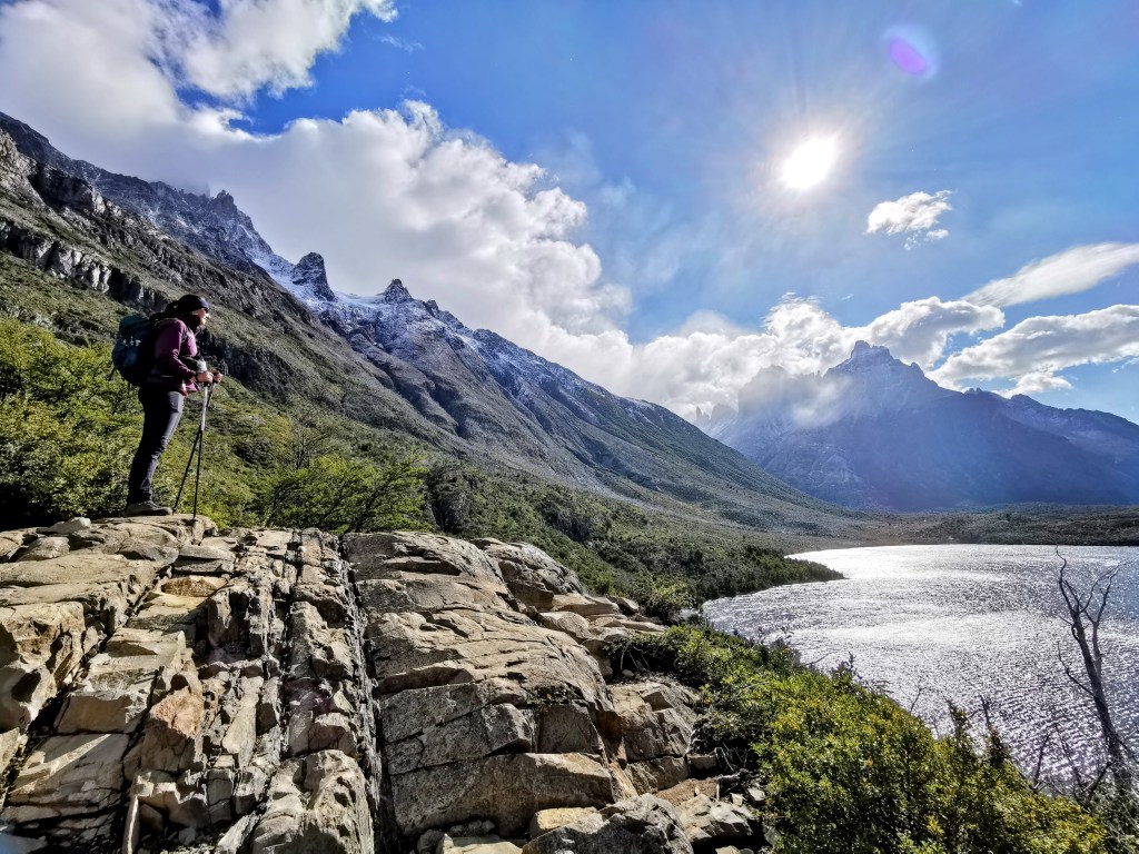
We finally set off just after 9am, and the first part of the day’s route takes you quite steeply back into the mountains behind the campsite. Due to the steepness, you get high up quite quickly. It seems that you’ve barely got going before there is one last view behind you of Lago Dickson and then it is lost behind the trees and then the curve of the mountain.

Walking through the pretty forrest was an interesting change from the previous couple of days, but there was a nagging feeling that we were missing out on views of the mountainous surroundings. It did, however, make it more spectacular when we came upon the mirador with panoramic views of the peaks all around us.

After enjoying the view, it was back into the forrest. As nice as the trees were, it got quite monotonous after a while, and my mood wasn’t helped by the development of the blisters that had started on the last stretch of the previous day.
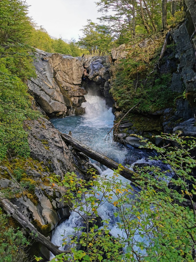
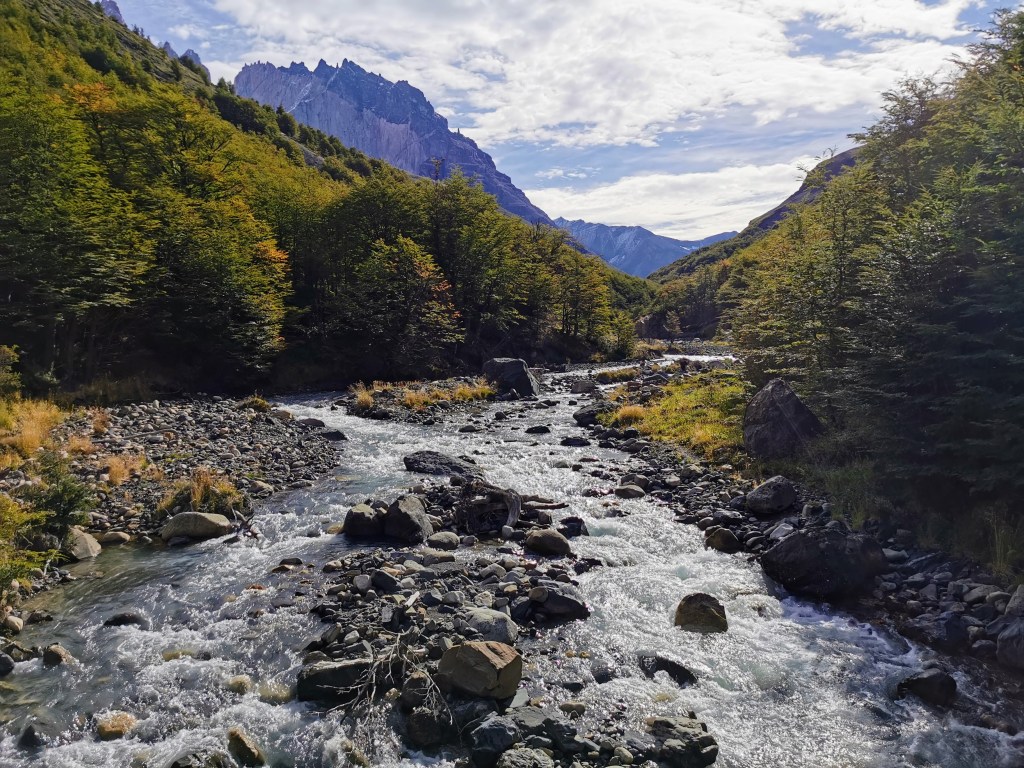
Luckily, after a while, we suddenly came upon a beautiful gorge. The crazily-blue glacial water and the dappled light and mosses on the rock edges lifted our spirits and made for a perfect place to stop for a snack.
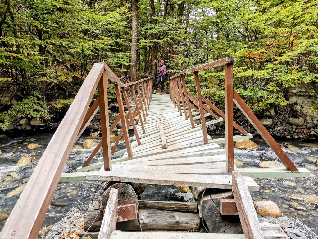
We were now following the path of the river, and the sporadic views and sounds of the flowing water made for a much more interesting hike. At one point we crossed a bridge and got our first view of the Los Perros Glacier, after which the campsite was named.
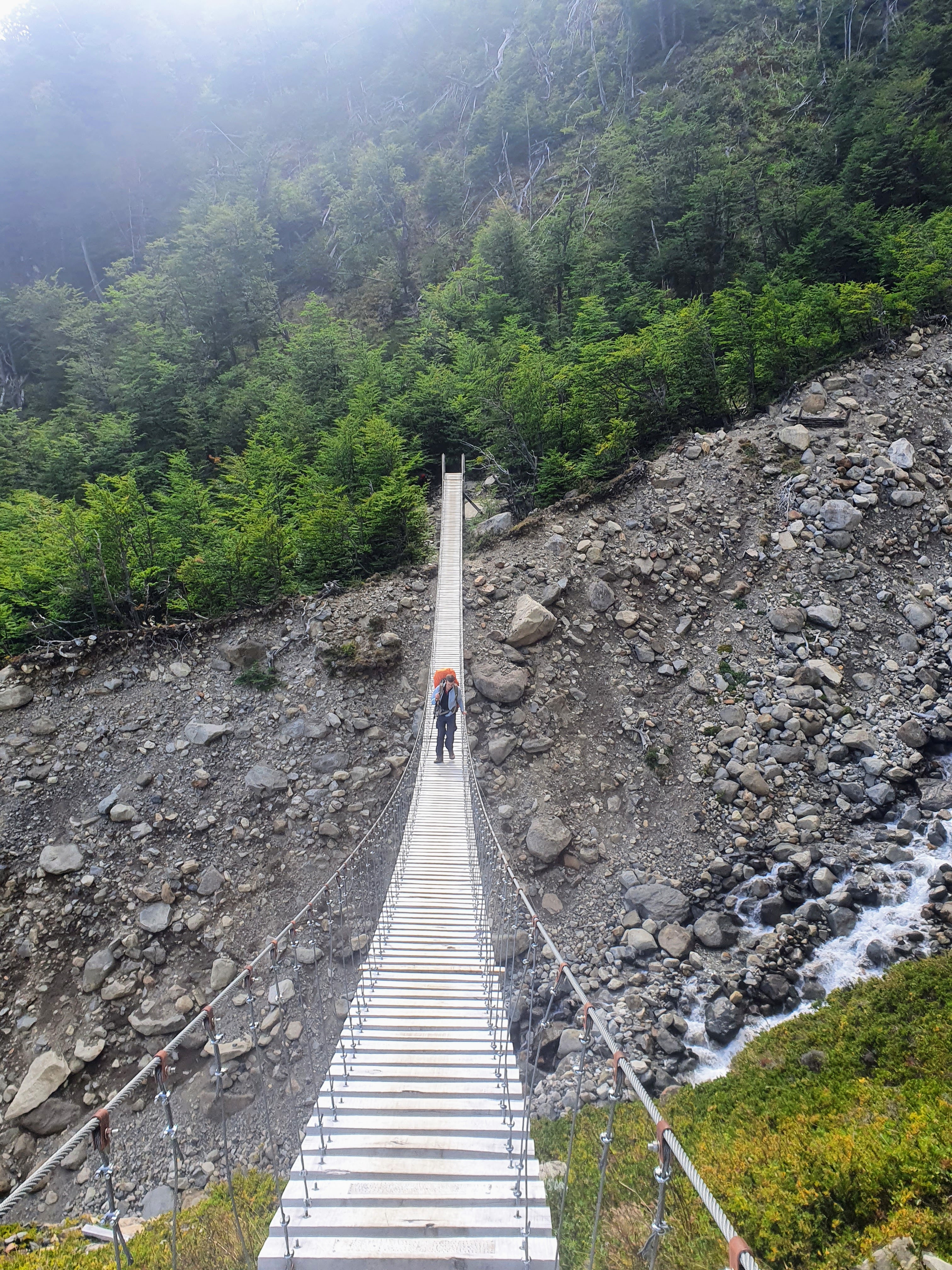
Whilst that bridge was fine, the same could not be said for all of them on this stretch…
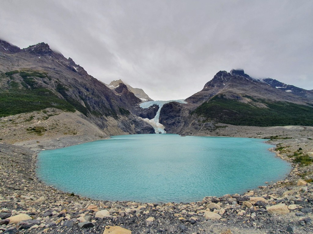
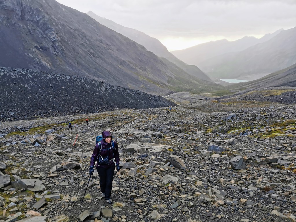
The section up towards the glacier was fairly nice, but I just couldn’t appreciate it as my feet were getting more and more sore. Meaning that when we arrived at the rockier ground and climbed over the lip, I was just unable to share in Radka’s exultation at reaching the beautiful lake at the base of the glacier. I was even less willing to stay standing and have photos taken as I swung off the bag and sank onto the rocky shoreline. This should have been one of the highlights of the extra section of the O-trek (in comparison to the W-trek) and even in the mood I was in, I could still see that it was a stunning spot. Another issue in appreciating it was that it was very windy up there, and it started to rain soon after reaching the point. So, we didn’t stay as long as we could have done and, after taking a few photos, headed on down towards the campsite.
It was not much further to the campsite and after checking in, Radka went to have a late-lunch with the Czech / Slovak couple whilst I just crashed in the tent. I was just done! Thankfully I’d revived a bit later in the evening, so we had our pot noodles (thanks for the hot water C/S couple) before playing cards with some of our fellow trekkers. So, it was a pleasant ending to what had been quite a challenging day.
Day 4 – Camps Los Perrso to Grey, via the John Garner Pass
It was time for the hardest day of the O-Trek. Not only is this the longest day in terms of time and distance, it also requires you to traverse the infamous John Garner Pass.
Given the distances we needed to cover that day, we woke up at 5:30am and left whilst it was still dark. Thus, we needed our head torches for the first section, which was through a forest. However, the light provided didn’t make it particularly easy to walk on the slick branches that helped you try to avoid the large patches of mud.
I was thankful that my blisters were much better but poor Radka now had some, and this really wasn’t the day to have sore feet! After leaving the forest and starting on the barren, rocky terrain, we were greeted with a spectacular sunrise behind us. Upon leaving the shelter of the trees, however, we were also greeted with the first blasts of the wind. There was a flatter area where we tried to take a photo with the sunrise behind us and yet it was hard to stand still. We had been told by the rangers that there would be high winds (up to 100km/hr) and it would get worse as the day progressed, which was another reason for leaving so early. As we stood on that patch of loose rocks, trying to keep our footing and staring into the camera, we could well believe the numbers and it caused some apprehension at the altitude we still had to gain as we approached the pass.
The trek up towards the pass should have been amazing, with the spectacular, rugged terrain and steep mountains either side of us. As we got higher, we were even treated to the sights of multiple hanging glaciers dotted amongst the peaks. And yet, the wind just turned it into one hard slog. At one point, a rain cover came streaking past us down the slope and we both laughed at how surreal the situation was. And yet neither of us noticed when the same thing happened to Radka!
The further up we went the stronger the wind became, and to make matters worse it started to rain in patches before becoming a constant drizzle. I’ve never experienced wind like it. On multiple occasions I just had to stop walking and lean into the wind until the main gust had died down. And I nearly fell over a few times when a surprise gust would catch me mid-stride. Luckily I was never caught at the angle that would have meant I would lose my balance completely.
As we approached the top of the pass we walked by a large boulder that provided a momentary respite from the driving wind and rain. We took the decision to take off our coats so that we could add more layers underneath. In the frantic desire to do it as quickly as possible, I lost the bracelet I’d picked up on the Caribbean Coast in Colombia. We were so glad we put on those extra layers, however, as when we reached the top of the pass, the weather was just ridiculous. As well as the wind being at its strongest, it was bitterly cold. Given that we could barely walk, never mind try and take photos, I tried to just use the GoPro, as it had a strap I attached to my wrist. The battery had been fully charged and yet it only lasted a minute or so before losing all power and switching off due to the temperature. To make matters worse, the wind pounding into our faces was now either mixed with hale, or the wind was picking up dust and grit, which were stinging our cheeks. This should have been a moment of triumph where we could sit, rest and enjoy our accomplishment. But there was no chance of that.
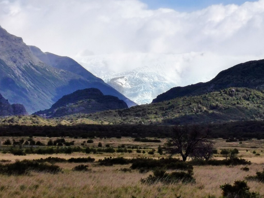
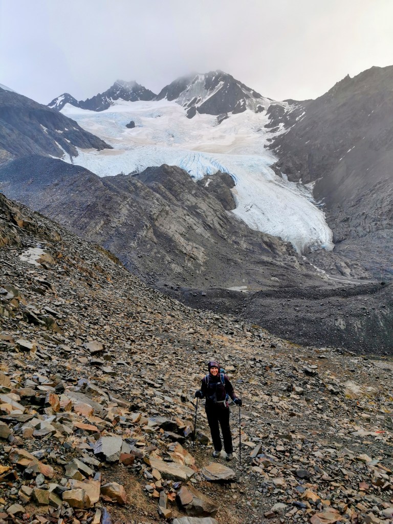
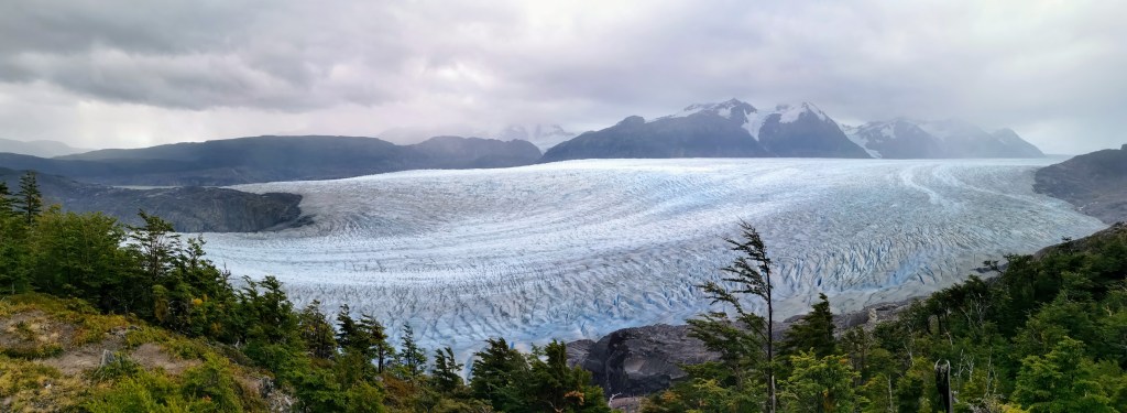
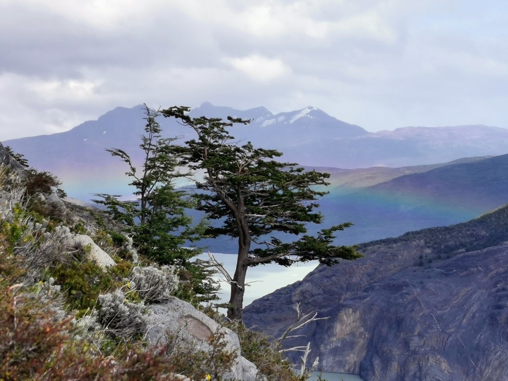
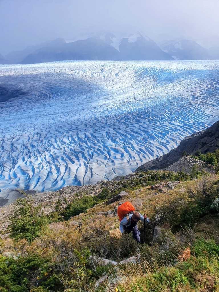
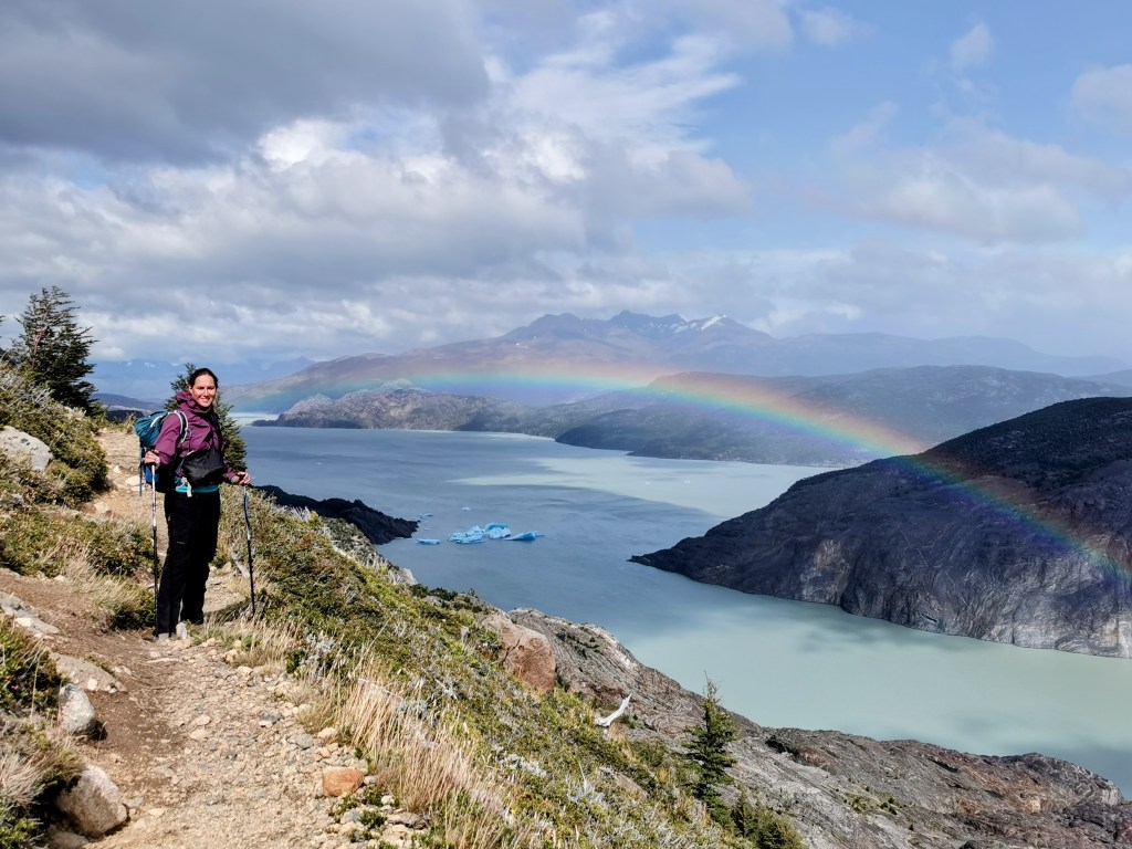
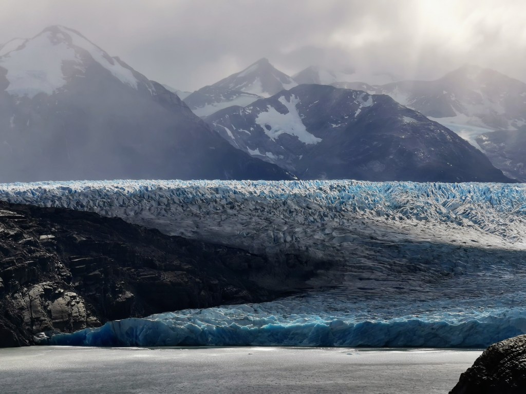
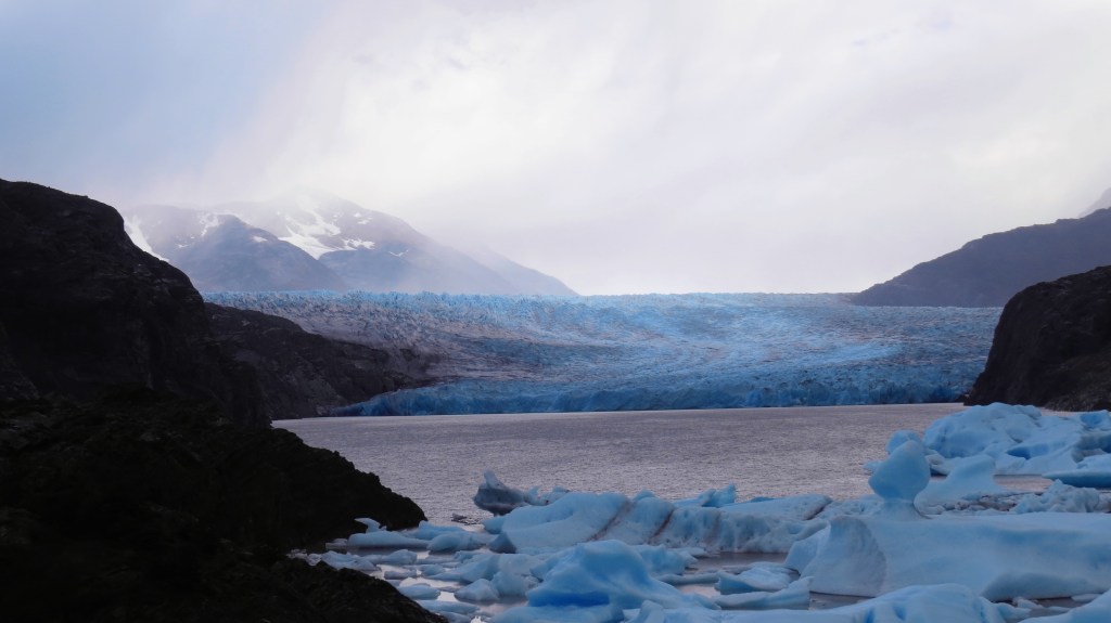
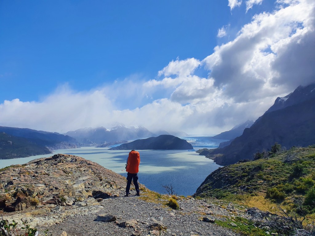
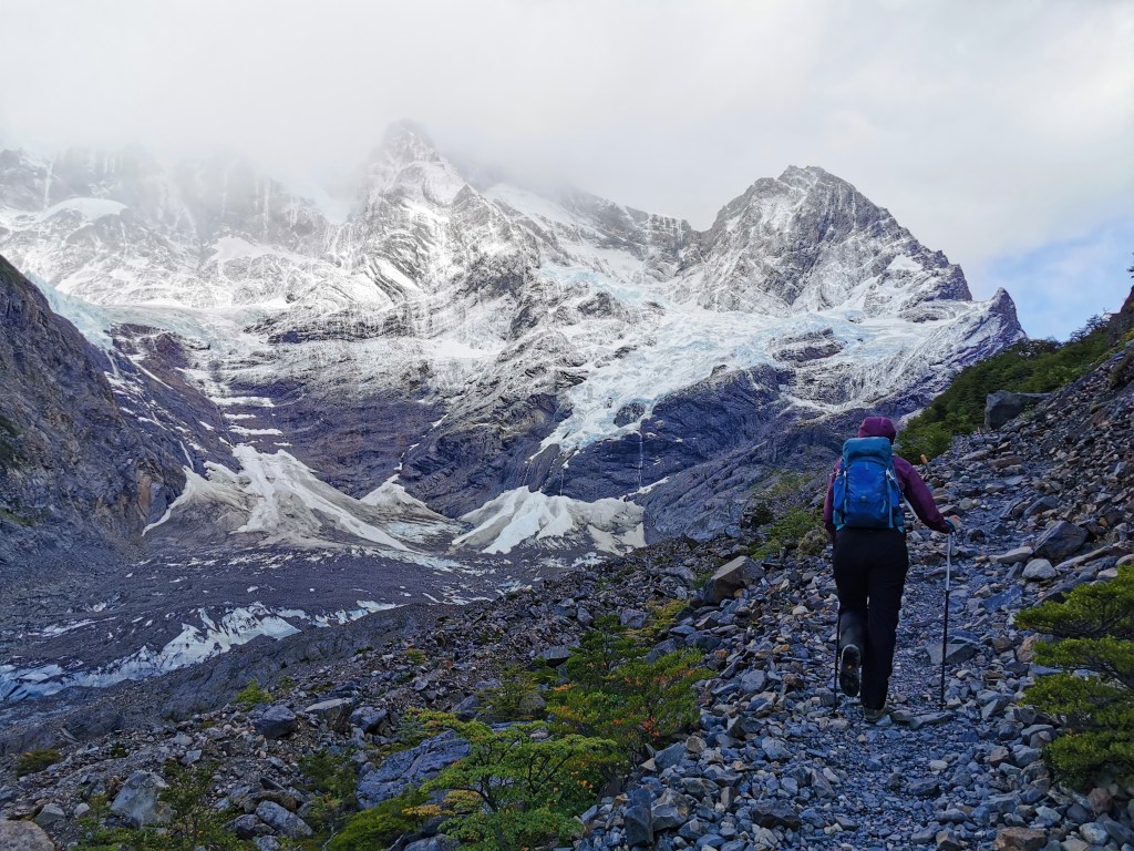
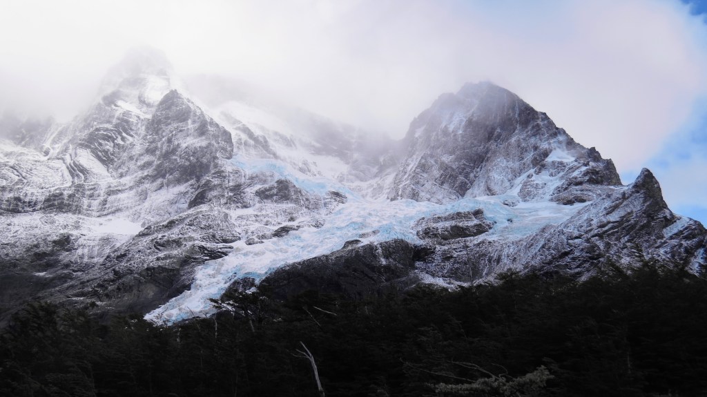
Almost as soon as we got off the top and started to head down the other side of the pass, the conditions did slacken off ever so slightly. As well as the wind becoming slightly less intense, the view ahead of us started to partially clear. Whilst only minutes before all we could see was a wall of cloud, now we could start to make out the far mountains, towering over a huge cloud-filled valley. It was only after carrying on for a bit longer that we realised that it wasn’t actually cloud in the valley, but Grey Glacier spread out before us. I had no idea quite how vast it is. There was even a rainbow above it to greet us, but once again, what should have been a highlight of the whole trek was just not enjoyable in the slightest. It was just a moment we had to get through as quickly as possible, with no thought of even trying to take it in.

Despite the conditions not being as bad as they had been at the top, it was still pretty unpleasant as we descended towards the tree-line. Even the point where we walked over the lip to be able to see the glacier in all of its glory ahead of us was not enough to draw more than the briefest of smiles.
Upon reaching the trees we were hoping for some respite, and whilst we were sheltered from the wind and rain, the path was very steep. Given that we’d just had a tough climb in terrible conditions, the gradient of the path was murder for our tired limbs and Radka’s blistered feet. The steepness of the path at this point is actually one of the reasons why you aren’t allowed to do the trek in the opposite direction.
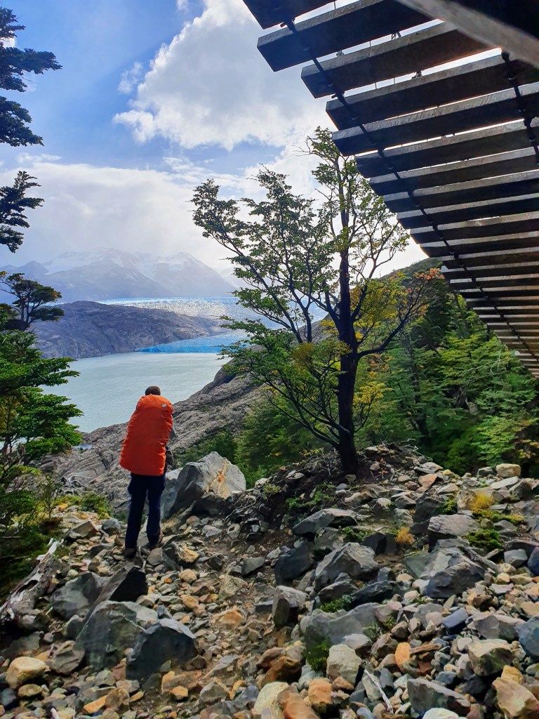
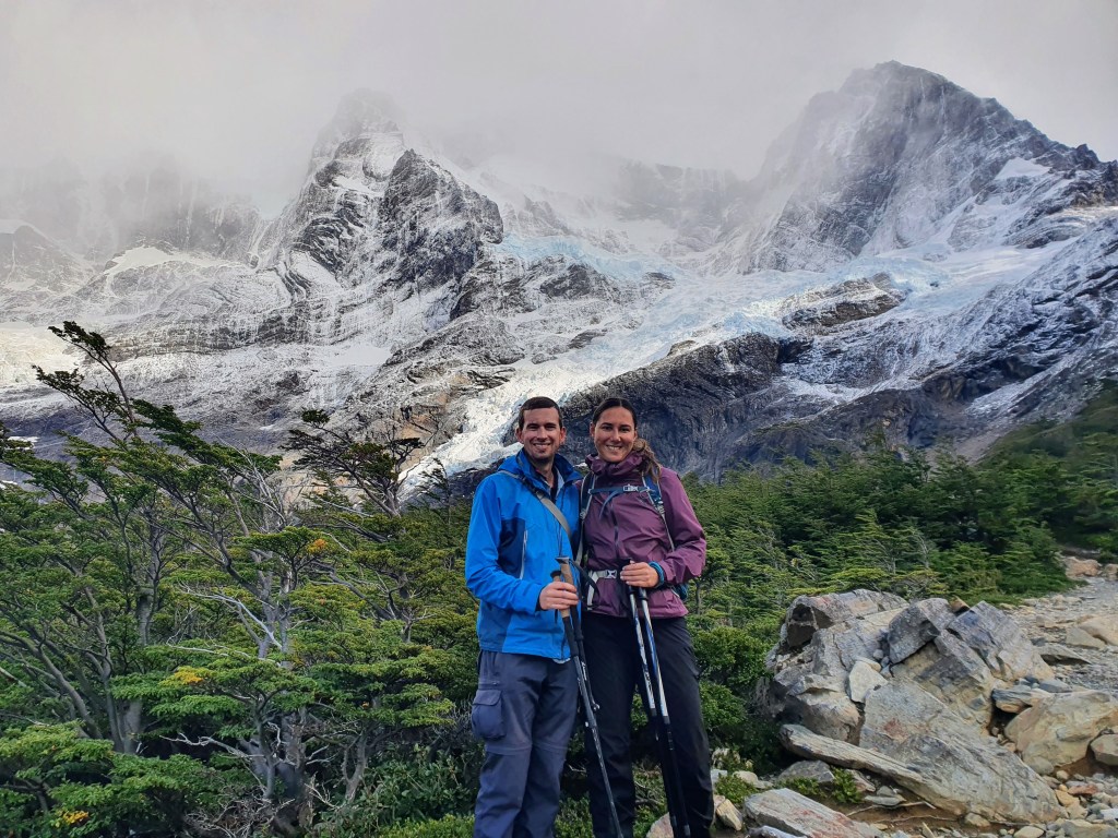
This meant that we were both more than a bit grumpy when we reached the first of the forest viewpoints. This was a lovely spot. It was sheltered from the wind, it had stopped raining and there was even the odd bit of sunshine illuminating the stunning swathes of blue that ran through the ice below. This was probably the first time that day that we were able to enjoy the views around us. The vista was stunning, and as we sat there another rainbow sprang up over the ice. We had lunch and had a nice, reasonably-long break to try and recuperate a bit.
Unfortunately, there was still quite a way to go and because the conditions had forced us to travel quite slowly in the morning, we couldn’t stay for as long as we wanted. But by now the wind had died down and there was only the occasional drizzle, so it was a lot more pleasant. The path was no longer as steep either, so we were able to make good progress as we passed through the closed Camp Paso and continued the walk through the forest and then onto an area with more shrubbery and less trees. From here, there were more open views over Grey Glacier.
We passed by another large swathe of burnt trees, which was sad to see, especially because of the scale. However, it did seem to match the harsh conditions and made the section quite atmospheric.

The next point of note was the first of three long suspension bridges that take you across ravines in the hillside. We found it quite cool until we were halfway along and the wind picked up again…
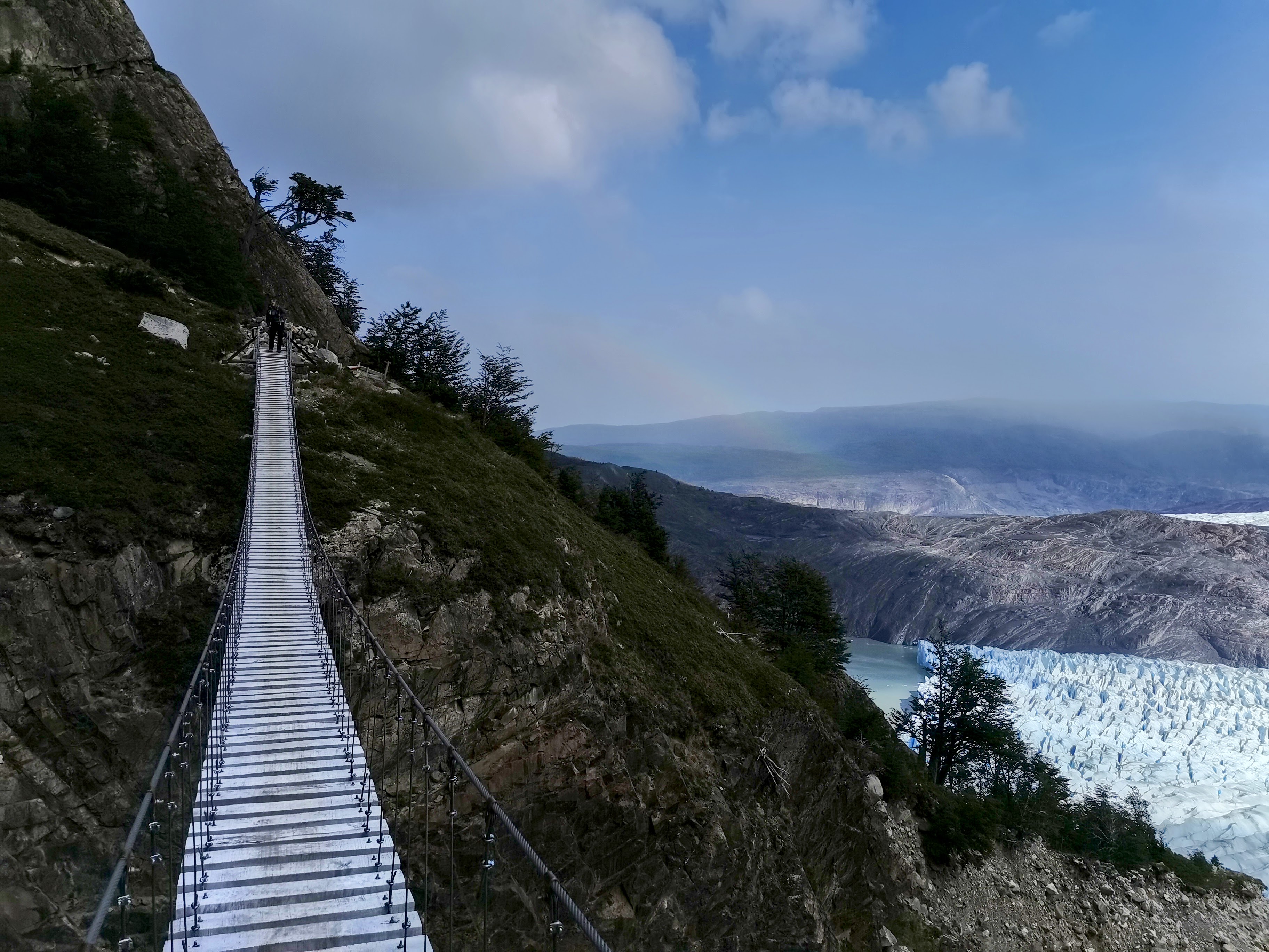
As we carried on, there were a few more viewpoints with the sun shining on the glacier but what should have been a lovely walk along the cliff face with unobstructed views of the glacier, was soured by the return of the strong winds. Whilst Radka was fine, it made me very nervous being on those narrow pathways with the drop to one side.
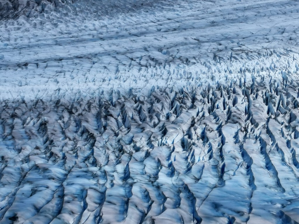
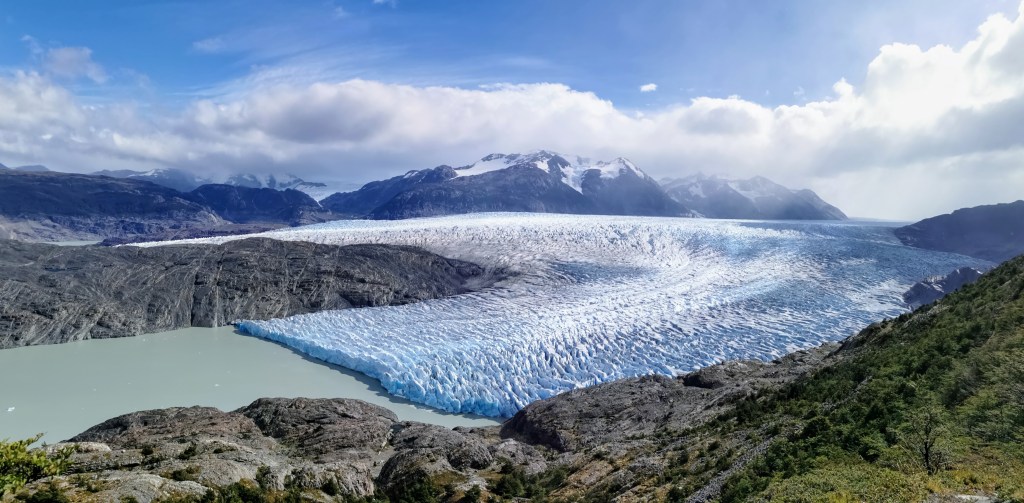
We were now approaching the point where we were parallel to the end of the glacier. For some reason, it was quite cool to have such a distinct end-point, although I’m not sure exactly what I was expecting! It was also interesting that there was a rocky ridge in the middle of the glacier and you could see the ice extended to about the same point on either side of the ridge. The Sun was now shining quite strongly and it was a bit of a shame to be leaving the glacier and now have it behind us.
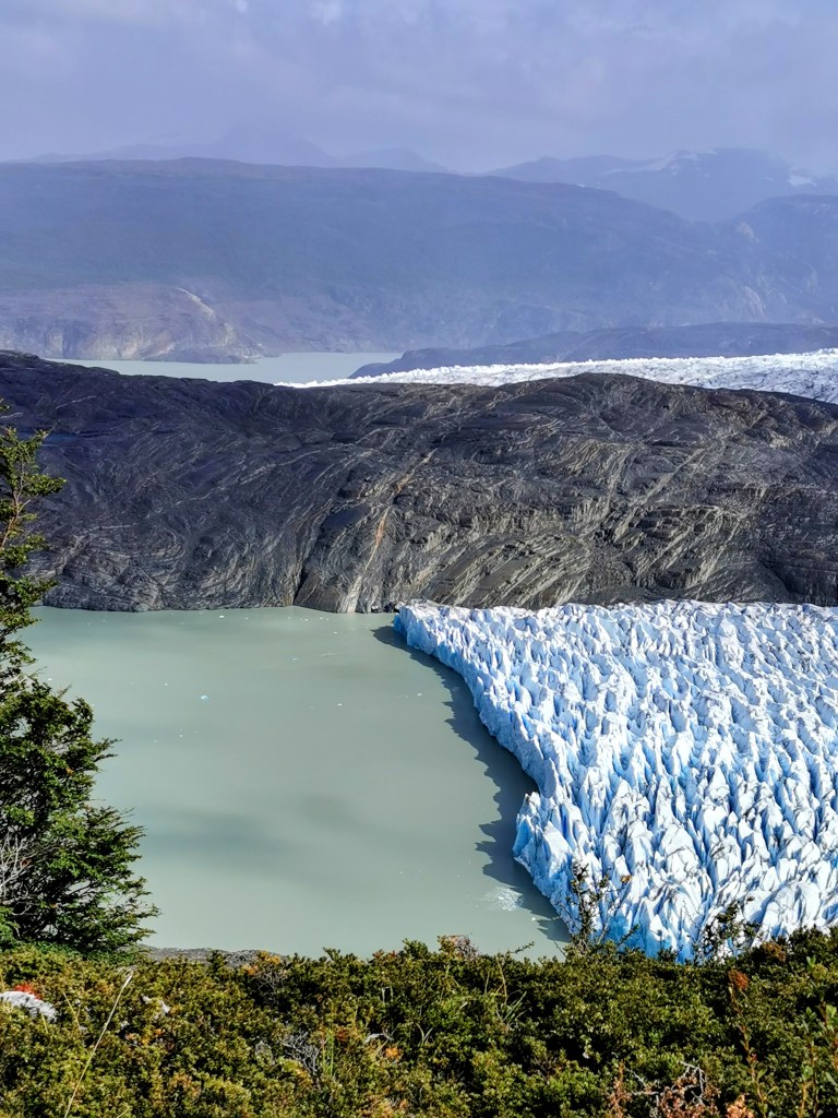
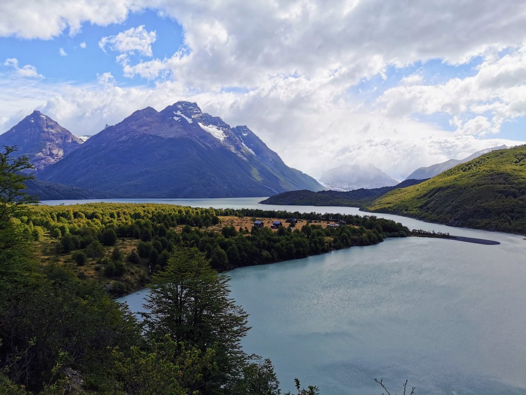
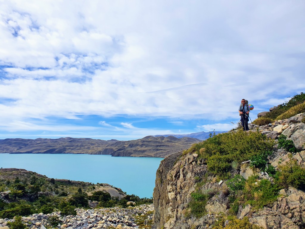
The route now carried on parallel to Lago Grey. The lake itself was still very beautiful and there a few large pieces of ice that had become detached from the main glacier and were floating independently at various points in the vast waters.
Of course we could still look back and see the glacier and it was nice to get different perspectives of it and having the contrast of the water and the edge of the glacier seemed to make it even more impressive.
The remaining route to Camp Grey was quite varied, dipping back into the forest for a bit and passing over a further two suspension bridges. There was now no real difficulties in the route and the only ‘hardship’ lay in having to pass the multitude of fresh faced hikers who were either doing a day trek to see the glacier or were walking to the starting point of the W-Trek. It sounds stupid but we felt a real resentment towards these people (who had done absolutely nothing wrong) in that we felt they hadn’t earned the amazing views they were getting. And I guess we had just gotten used to not having many people on the trail.
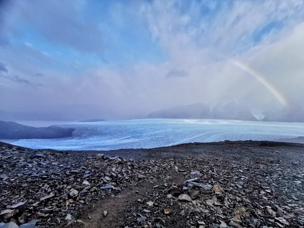
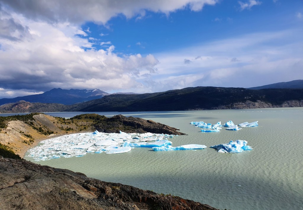
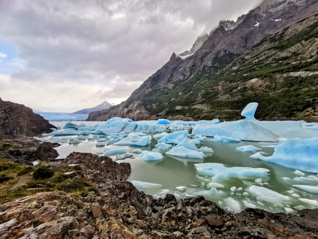
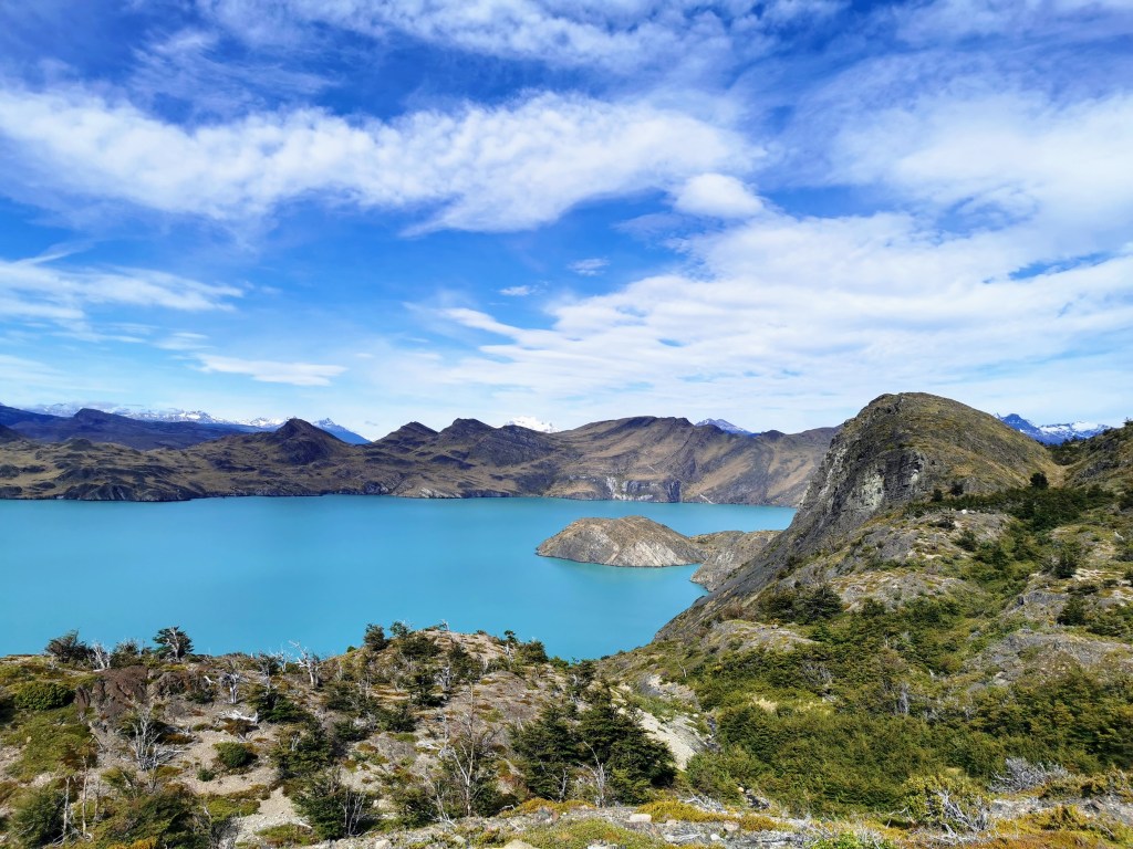
The conditions were now very pleasant and that meant that when the viewpoints opened up we were able to fully enjoy them. They weren’t all as obvious and distinct from the trail as they had been previously, which meant that we often were the only ones sat enjoying them. One such viewpoint as we approached the campsite allowed us to have amazing views of ‘the bay of mini-icebergs’ (we have no idea what the proper name would be), where the chunks of ice that had broken away from the glacier had congregated in a pretty crescent bay.
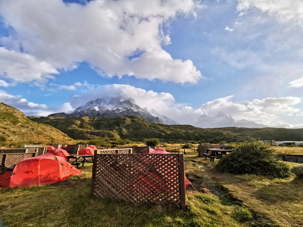
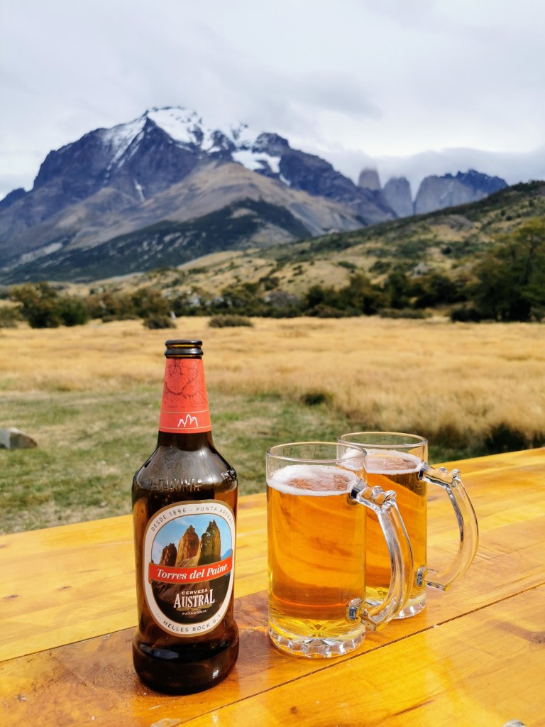
It was amazing to finally arrive at Camp Grey. We even treated ourselves to a very hot but very appreciated shower before having dinner. The food was a little bit disappointing compared to the other nights, given that Camp Grey is more accessible and we were maybe expecting better, but it was still nice. Asparagus soup, chicken with mashed potato and salad, followed by a tasty chocolate brownie. We also had a beer to celebrate the end of what we hoped would be the hardest day of the trek.
Day 5 – Camps Grey to Paine Grande
Given the length and difficulty of the day getting to Camp Grey, it is generally advised to take day 5 pretty easy. And that’s what we planned on doing, with only a short hike to Paine Grande campsite on the agenda. As such, we had a relaxed morning and the kitchen even gave us a couple of yogurts for free to go with our cereal.
After getting packed up, we left our rucksacks at the campsite and did a slight detour back to see the ‘Bay of Icebergs’. We were accompanied by the Czech / Slovak couple, who would also be walking to Paine Grande that day. The bay was really beautiful, with the mini-icebergs often having the stunning glacial-blue colour and many of them also having very interesting shapes. We also walked up to the headland looking back towards Grey Glacier to admire it once again. It was really cool to see it from another perspective. Whilst walking above it you don’t really appreciate how tall it is and it looks fairly flat, but looking back from nearly water level, you can really see the scale of it and the variations in height.
By the time we got back to the campsite and got ready to go, it was already approaching midday. But that still left more than enough time for the days walking. The first part of the walk was climbing up for about 250m and we had intermittent views backwards towards the glacier. At one point we could even see the two arms of the glacier reaching out to both sides of the rocky outcrop.
During this time we also passed through another large area of burnt trees, which made it easy to see the waterfalls positioned high up on the hillside. Whilst to the right of us more rainbows sprang up over the lake.
Just after the top of the slope we stopped for a lunch of salami and crackers. As we had approached the highest point the wind got progressively stronger again, so we were happy to get over the top and start getting down to where it was a bit more sheltered.
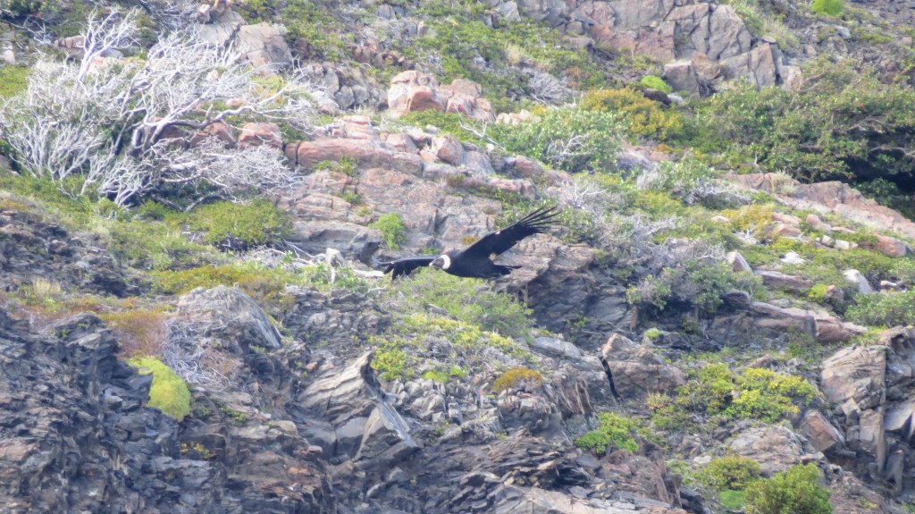
The path down was fairly uneventful, although it was interesting how the environment changed – it looked more and more like Scotland. The highlight of our time walking on Day 5 was probably Radka spotting a condor. The poor thing was struggling with the wind but at least this meant that it was travelling slow enough that we were able to try and get a photo.
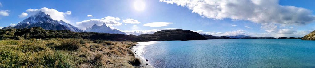
The path down also gave us our glimpse of Lago Pehoé, its brilliant blue waters contrasting with the pastel shades of the surroundings. Paine Grande campsite was situated down by this lake and didn’t take too long to reach.
Once at the camp we had some food with the C/S couple in the kitchen area before sitting and chatting to the ‘dinner crew’ for a bit later on in the dining room. It had been a very relaxing day in contrast to the one preceding it!
Day 6 – Camps Paine Grande to Frances
This was the first day where our ideal itinerary differed from the one that we were able to book. Whilst our companions walked all the way to the Británico Viewpoint before backtracking and spending the night at either the Italiano, Frances or Los Cuernos campsites, we were unable to schedule the same. Due to booking the trip fairly last minute, we were not able to align the remaining campsites in a suitable way. So, in the end, we decided to book an additional night and effectively have an extra rest day. Our fifth day, therefore, only required us to get to the Frances campsite, and we would walk to the viewpoint as part of our sixth day.
Thus we were able to have another slow morning. We got yogurt from the shop and cereal from the ‘left over box’ for breakfast. Radka also managed to get a freshly baked loaf of bread that was still warm for ‘only’ 4000 pesos… We also managed to purchase some cheap sandwiches that people had ordered but then forgot to pick up, which was one of the advantages of leaving later.
It was about 10:30am when we eventually set out. It was nice and sunny (but very cold) as we first walked down to the lake. The colour of the water was absolutely amazing and there were great views of the mountain peaks sticking out of some localised clouds, which we would be walking towards during the day.
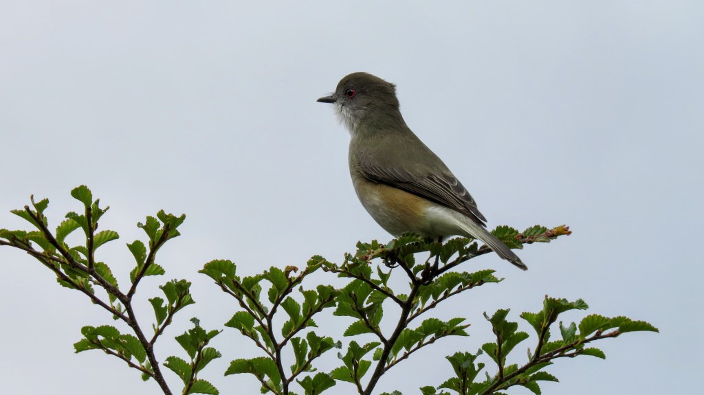
As we started walking away from the camp, we saw two hawks flying over the water. Apart from the condor the day before and some smaller birds in the forest, we hadn’t seen that much wildlife, so we took this as a good sign.
We then walked up towards Lago Skottsberg, passing by a very picturesque little stream. The mountains to our left were very cool. There seemed to have been snow overnight that coated the peaks, whilst the clouds were also drifting over them in mesmerising patterns.
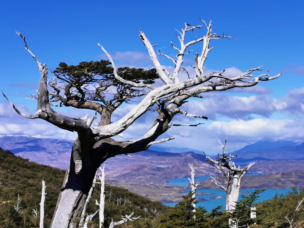
The path continued through another area of white, desolate trees; before carrying on along the edge of Lago Skottsberg, with some picturesque views over the water.
After leaving the lake, the path heads north-east through some trees before reaching a branching point, where you can either carry on towards Camp Italiano or turn east towards Camp Frances. It was interesting to see up into the valley that we’d be hiking to the following day on our way to the Britanico Viewpoint.
As you near Camp Frances you start getting nice views over Lago Nordenskjold and not far after that you reach the camp itself.
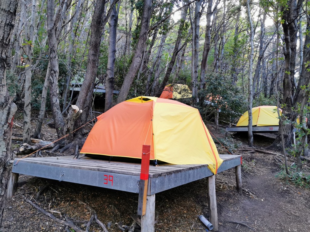
The layout of Camp Frances is a bit weird. It is in a sloped forest so the tents are spread out on platforms. The main buildings, including the toilet block and the restaurant, are situated further down the slope, meaning it is a bit of a walk to get from one to the other. So, when you’re brushing your teeth in the evening you’ll definitely need your head torch!
Later on in the afternoon, after getting sorted in our tent, we went and had quesadilla, wine and beer with our remaining hiking companions. It was the last night we would see them on the trail as they were now ahead of us in the schedule. We had a really nice chat and it was fun to moan about all of the happy people doing the W-trek (turns out it wasn’t just us being grumpy about it!).
On the way back from the wash block in the evening my headlight illuminated a pair of eyes darting underneath the office building. I don’t know what it was as I didn’t get a good look, but from the eyes I’d guess it was the size of a big cat – so maybe a fox?
I liked how there were reflective patches put on the signs and tents. Over the next couple of days I even noticed them on the routes, mostly on the signs but also on the odd tree or rock. It’s certainly a good idea for if someone gets stuck walking after dark.
It was easily the coldest night of the trek so far. I had to wear a second pair of trousers, my down jacket, and tunnel overnight… It worked though!
Day 7 – Camps Frances to Los Cuernos, via the Frances and Britanico Viewpoints
The day started slower than expected, partly because we were able to leave our main packs at the campsite and therefore had to organise our day-packs. But the plus side of the slow start was that we got to see all of our companions before they headed off. The reason that we were able to leave our packs was that we would be going back to hike to the Britanico Viewpoint and then we would be returning via Camp Frances before continuing on towards Camp Los Cuernos.
As we retraced our steps towards the turn-off for Camp Italiano, the weather was nice but there were clouds sat on the peaks of the valley we would be entering.
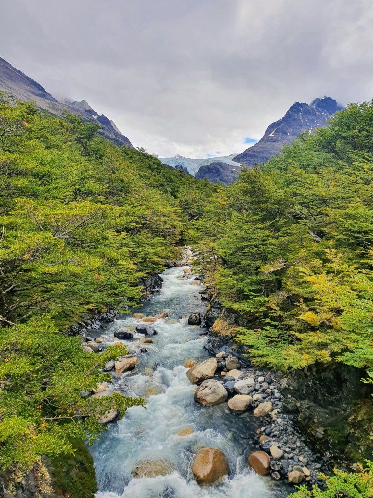
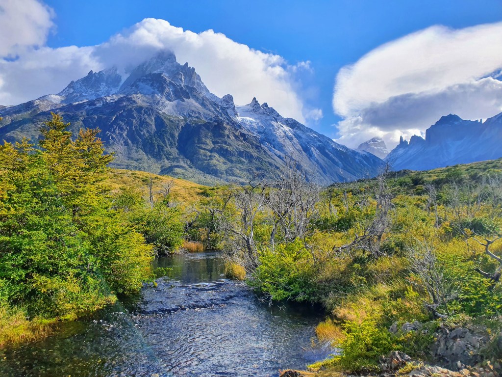
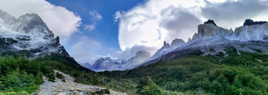
After the turn-off, you head through the forest, following the stream and at one point, walking up the stream itself. As the path winds higher, you repeatedly come back to the stream and the sound of the water makes for a very pleasant soundtrack for the ascent. Despite the clouds, the views of the mountains either side are very impressive and when you looked back, the glacial blue water of Lago Nordenskjöld jumped out of the surrounding landscape.
The panorama from Frances Viewpoint was stunning. To your left as you’re walking up, there is a massive mountain glacier with its blue hue standing out against the snow, whilst to your right, you get a glimpse of the tops of the towers in a further valley.
As you head off towards the Britanico Viewpoint the terrain alternates between forest and rockier, more exposed ground. The views got better and better as the clouds started to thin.
We stopped by the river to have a break and a snack. In her enthusiasm to open the bag of Gummy Bears that she had been saving, Radka managed to split the bag with such force that every sweet was scattered on the ground all around. So I don’t think she was quite as able as I was to appreciate the picturesque river setting…
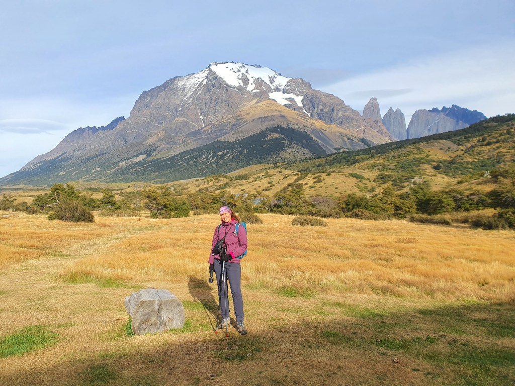
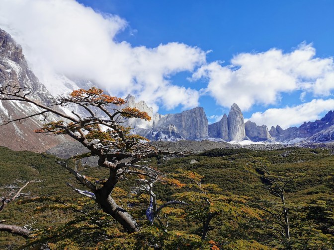
At one point you enter a large rocky open area with great views all around you. When I had done the W-Trek years before, there had been a snow storm on the day when I had tried to walk to the Britanico Viewpoint, and this area was as far as I got to before heading back. The contrast between the two days was stark, as now the clouds were reducing and the sunshine and blue skies were a very welcome addition.
After another section walking through the trees we reached the viewpoint.
The views were spectacular. As well as the mountains we had seen during the walk up the valley, there are a ring of peaks that you only really start to see from the viewpoint. We spent about an hour here, enjoying the views and having lunch. By the time we had to leave the Sun was uncovered and the clouds were all but gone. It was amazing to again see snowy peaks against a blue background.


The return journey followed the same route back. And yet due to the improved weather, it was like seeing it fresh all over again (also meaning we wanted to re-take lots of photos…).
We again stopped at the Frances Viewpoint to admire the views and we’re glad we did, as whilst we were sat there, there were two avalanches high above us which were pretty spectacular to see.
We had to rush a bit after that, as we still had quite a bit to go to get to Los Cuernos Campsite. But we were still able to appreciate the views ahead of us down towards the lake.
After collecting our main packs at Frances campsite we still had to get to Los Cuernos. It was supposed to take 2 hours and we had 2 hours 10 minutes before we had to be there for the evening meal, so we again set off at a fast pace to try and make sure we got there in time.
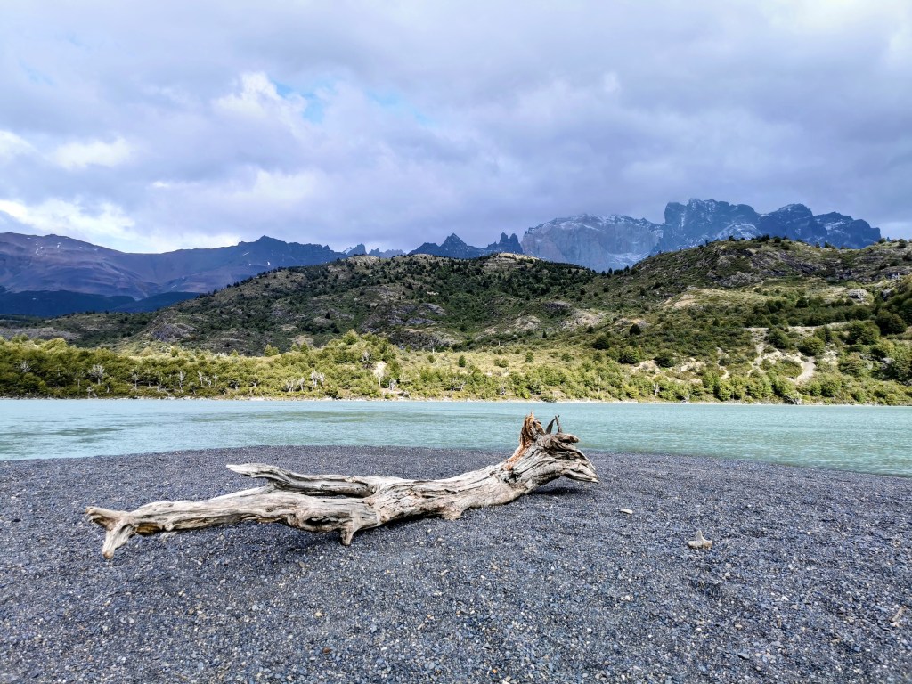
The route provided some beautiful views of the lake, which had an amazing glacial blue colour. And at two points you even ended up on a pebbly beach – the hike is so varied in terms of your immediate environment.

We made it in about 1hr 15 minutes, so we even had time for a nice hot shower before dinner. The food was interesting. A spicy tomato soup followed by salad and then a weird looking dish of chicken in some sort of black bean and mushroom sauce with something like mashed lentils. It looked weird but was pretty good. The meal finished with Calafate ice-cream. We even ended up ordering hot chocolates afterwards and stayed for a while chatting to a Brazilian couple, before heading back to our tent.
It had definitely been our favourite day of the hike so far. The views were spectacular, the weather had been fantastic and it definitely helped that we didn’t need to carry our packs for most of the day!
Day 8 – Camps Los Cuernos to Chileno
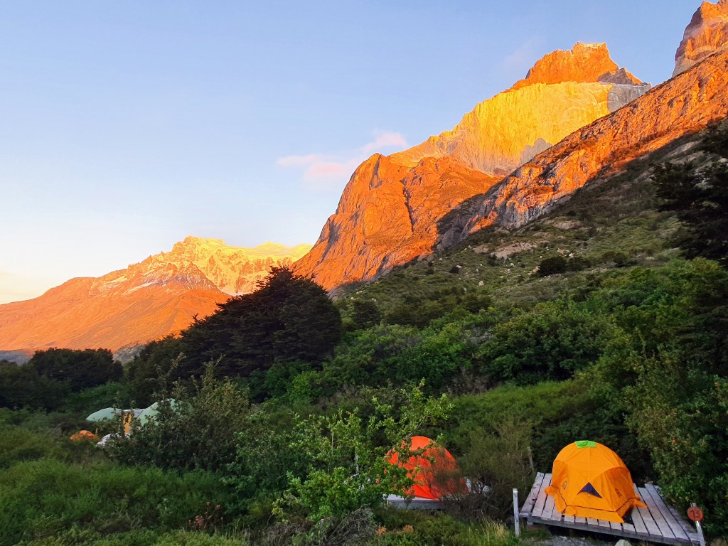
We were up nice and early on the morning of my 34th birthday. And as I was in the wash block I heard Radka shouting at me to come out as the dawn was turning the surrounding mountains a fiery red colour. It was a spectacular way to start the day.
And then upon returning to the tent there was a nice surprise waiting for me in one of my boots…

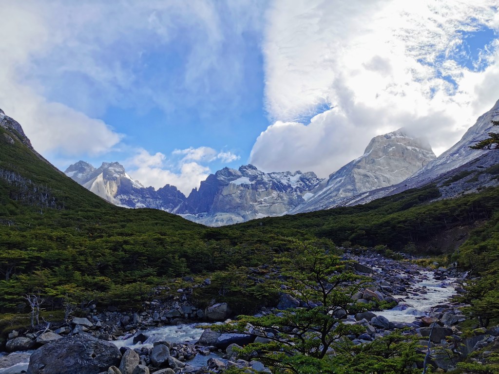
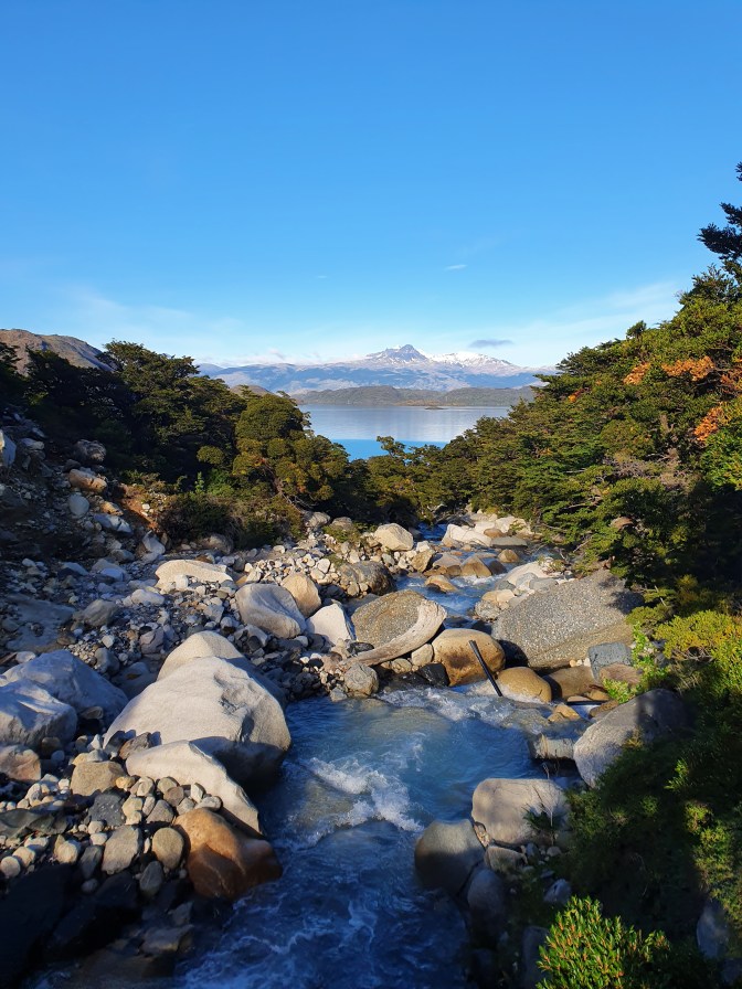
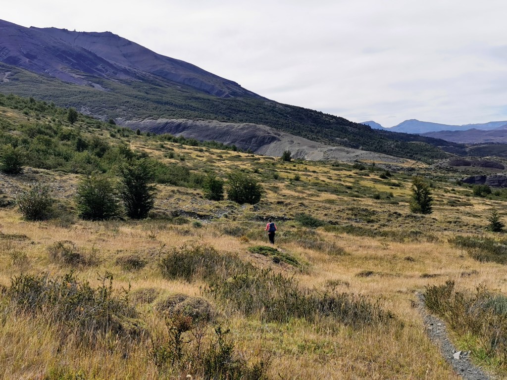
The weather was amazing so it was a very pleasant start to the day’s trekking. This particular area is quite green, so you’re hiking through lots of small trees and bushes. At one point you cross a bridge over a picturesque stream that is heading down towards Lago Nordenskjöld.

We had not been walking long before we reached an amazing viewpoint. The beautiful blue sky highlighted the snow capped peaks that ringed the lake. This was the sort of view we’d been hoping for, basically since we started traveling! We had had so much cloudy and rainy weather during our hikes in South America that we were able to really appreciate when we did get a day like this. There were even some handily placed boulders that allowed us to get above the surrounding shrubbery and we stayed for quite a while taking far too many photos.
The path then continued up through the rocks and shrubbery, cutting off a headland that jutted out into the lake. The route then carried on parallel to the lake for quite a while, giving great views over the water.
Unfortunately, by midday the clouds started to appear from behind the mountains. The best views were behind us leading Radka to speculate how it might be nicer to do the W-trek in the opposite direction but we eventually concluded that it wouldn’t make much difference.
We stopped at an outcrop with a nice view for lunch. Well Radka had lunch, my stomach was a bit iffy – I think from the soup the evening before. Whilst we were sitting we heard, and then saw, a hawk flying behind us. It was nice but we thought no more of it but then a bit later, as we were sorting our bags to leave, it flew directly over us. Unfortunately a camera wasn’t to hand as the sun behind it illuminated the beautiful colours of its wings. It was so close you could make out the details and patterns and was a really cool experience.
Not too far after our lunch spot, the path started heading away from the lake and up into the hills.
The walk up towards Chileno was a bit tough going. Whilst not overly steep, it was a constant ascent through the grasslands. However, we maintained a pretty good pace as there wasn’t many photo stops due to the monotonous nature of the surroundings – I think we’d just become a bit spoilt due to the amazing views during the hike! One positive aspect of this part of the walk came because I’d attached the balloon to my rucksack so I received a few well wishes from people travelling in the opposite direction.
We eventually reached the ‘Windy Pass’. This was the highest point of the day and had nice views back along to the lake and in front up the valley to where you could see Camp Chileno down by the river.
The path then had a couple more steep up and downs before we reached our destination – Chileno campsite. The tents were again on platforms on a steep slope amongst the trees. After unpacking we went and sat outside the restaurant to have a beer with the Brazilian couple.
We had a bit of time to start sorting our stuff before dinner. The food was pretty disappointing. A very small bowl of lentil soup (but there was garlic bread as compensation), followed by chicken and rice and then a small but nice flan for desert. We sat in between the Brazilians and a couple of unprepared Americans who were just starting their trek…
Given the early start that was coming, we didn’t stay for long after finishing the meal. We had to try and pack up our stuff so that we were ready to go in the morning. We both basically wore what we would be walking in the following day, so that we wouldn’t have to change and could eke out every extra minute of sleep.
Day 9 – Camp Chileno to the Endpoint, via the Towers
The final day!
We slept reasonably well but it was still hard to get up at 4:30. We finished packing and left the rucksack in the back entrance to the tent. We didn’t want to pay for bag storage (a real cheek given how expensive staying at the pretty poor campsite had been) and we hoped that we’d be back before anyone noticed it…
It was 5:25 before we set off with our headlamps and small backpacks. Radka was still struggling with her feet but we maintained a slow but constant pace as we went through the trees and across streams as we made our way up the valley.
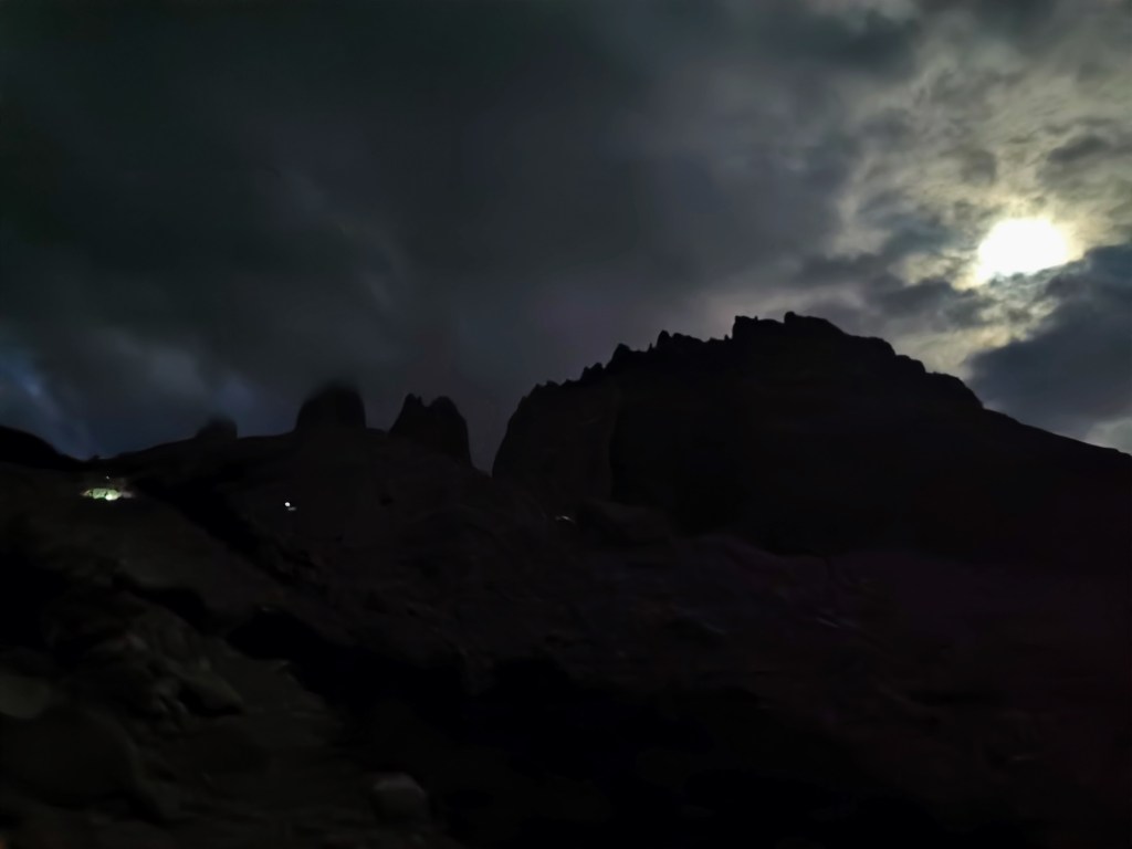
After the path bared to the left it became much more steep and tricky. At first you’re still in the forest but then you come out onto exposed rocky ground. It was here that you could first see the tops of the towers, silhouetted against the moonlight and general pre-dawn gloom.
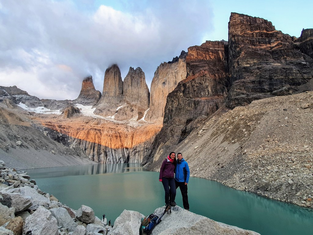
This path seemed to go on forever, as after you think you have reached the top, it then carries on going around the side of the slope until you reach a gap in the wall of boulders. Despite the hike taking longer than expected, we still had plenty of time before the first light would strike the towers, so we found a spot to sit and wait.
We were not feeling too optimistic about our chances though, as clouds seemed to cover the sky, and then out of no where the towers started turning red. The amazing effect probably lasted less than a minute, so just enough time to take a photo but not enough time to sit and take it in. But we were still very grateful we got to see it at all.
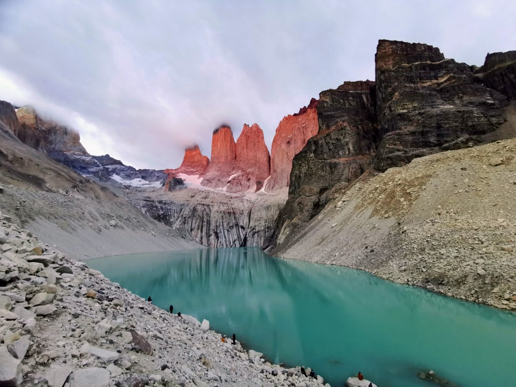
Not too long after, however, the skies started to clear a bit and when the Sun got high enough, it began to illuminate the rocks. This also looked very cool and it lasted long enough to appreciate it. We sat for ages enjoying the majesty of the view before spending equally long taking far too many photos – it was a nightmare sifting through them after we got back and trying to choose the best ones!
We were hoping the patchy blue sky would clear completely but the opposite happened and the cloud got thicker instead. But we were lucky in that we had probably had the best of the skies for that day. At one point in the early dawn a whole host of large birds started circling near the tower. Whilst we can’t know for certain, we think they were condors. If so, it was amazing to see so many together.
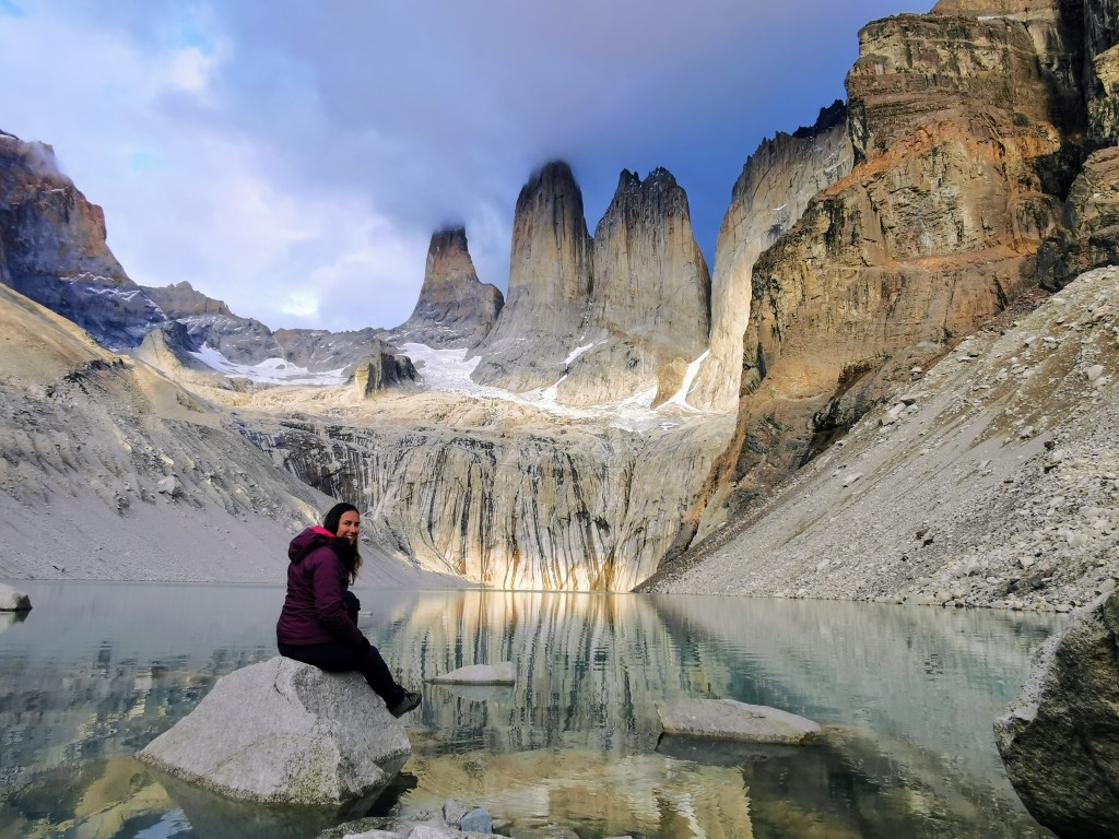
After ages spent up on the boulders, we went down to the lake for a different vantage point and met the Brazilians who had just made it for the sun rise. I’m glad we also got the view from down at the lake, as the reflections seemed even more impressive from that vantage point.
The walk back to Chileno was easier in the light and Radka’s feet didn’t hurt so much going down as they did going up, but it still took quite a while to get back to the campsite. Upon arriving, I went to get our bag but it wasn’t there. I searched around outside and in the buildings but I couldn’t find it. I had to ask the person at reception. They had the bag and charged me for the two hours they had ‘stored it’ in an unlocked room that anyone could have accessed… I really wasn’t impressed.
Given that we had plenty of time before our bus back to Puerto Natales, we sat at the tables and rested for a while. Despite still having to walk a fair way to the endpoint, we felt like we had finished the trek, and it was a nice feeling to have accomplished it. We also had a couple of nice wildlife encounters as we sat there…

Now that we had our full packs, it was quite tough to get back up to the Windy Pass but after it the route was downhill or flat for the majority of the remaining hike. It was certainly easier for us going down the slope than for the day trippers and those starting the W-trek going in the opposite direction. Now that we had finished, we didn’t feel quite the same level of animosity towards them.
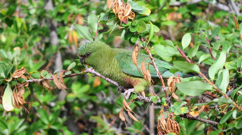
At one point we saw some movement out of the corner of our eyes and came across a flock of parakeets in the bushes next to the path! They were really close and it was very surreal. We got better views of the wild parrots here than we had in the Amazon Rainforest when we had been in Ecuador. We hadn’t realised that parakeets lived in that area, but after researching it later on, it seems that they were not lost and are specifically found in this region. This was a really cool experience to basically finish off our hike.
By the time we crossed the gorge and got down to the Torres hotel we were ready to be finished, but the end point was still a deceptively long way away. The last part of the walk is quite boring and when we finally reached the endpoint, it was a bit of an anticlimax. But we got a beer and an empanada and enjoyed the final views of the mountains while we waited for the bus.
After changing from the shuttle to the main bus at the entrance to the park, we were on our way back to Puerto Natales. Radka was soon asleep and thus missed seeing multiple guanaco and a rhea.
After getting to our hostel we crashed for a few hours before showering and heading out to meet some of our fellow O-treckers for dinner. We had to wander about a bit to find somewhere open but we eventually managed to find somewhere down by the lake. We had a nice meal and chat before saying our goodbyes and returning to the hostel for a well-earned rest. It had been a tough but epic nine days.
Final Thoughts
Well done if you’ve made it this far! This is probably the longest post I’ve written. But the O-trek definitely deserved the time it took to write a few extra paragraphs. It was an epic hike and we can see why it is so well thought of and on so many people’s bucket lists. I don’t really have anything left to say that hasn’t already been covered, so I will just leave it with our ‘Highlights and Lowlights‘:
Highlights:
– The view down onto Lago Paine on the second day. This view was dwarfed by others during the rest of the hike, but it was my first ‘wow moment’ during the trek.
– Getting to enjoy the views on Grey Glacier during the second part of the fourth day, having not been able to appreciate it when journeying over the John Garner Pass.
– The viewpoint of the icebergs near Camp Grey was cool.
– The views from the Frances and Britanico viewpoints and finally having some blue sky.
– The views over the Lago Nordenskjöld on my birthday.
– The illuminated towers from the mirador.
– Seeing condors and parakeets.
Lowlights:
– The wind. Almost a constant factor and ruined the climb over the John Garner Pass and potential viewpoints of the glacier. It also made other days more uncomfortable.
– The weather and lack of blue skies, especially during the first few days. I’m being pretty picky with this, as it could have been much worse, but it did detract slightly from the experience.
– Blisters. Radka’s were worse and lasted longer but we both had them at some point and they made the trekking more difficult.
– Being charged too much at the campsites for what you get, especially those run by Las Torres.
Well there you go, thank you so much for reading and I hope you gleaned some useful information about hiking the O-trek.

WOW!!! Fabulous photos. Great description. Amazing place. So beautiful! Shame about the wind and clouds but what a fantastic sounding hike. Well done.
LikeLike
Great description and impressive views – especially of that glacier end-point! 🙂
LikeLike