29th May – 1st June 2023
In 2020 Jan Hocek spent a lot of time during the COVID pandemic devising a series of inter-connected hikes in the Czech Republic that collectively are now known as the Via Czechia. There are six different parts to the Via Czechia, covering various key areas within the Czech Republic. Two of these, the ‘North’ and ‘South’ routes, form a loop that follows most of the Czech border and hence forms a circuit around almost all of the Czech Republic with a total distance of 2110km. A further project with a similar goal is the Stezka Českem. This non-commercial initiative, which translates as the Czech Trail, follows slightly different paths to the Via Czechia, but still completes a full circuit around the Czech borders.
I think it’s a fantastic concept and really fits with the Czech Republic, as most of the mountainous regions are along the borders. In the next few years I really think these trails will take off and become another of Europe’s famous long-distance trails, especially as their are sections of the route that can also be completed by bike or skiing. We were really interested in the idea of the Czech Trail, so when we were in the Czech Republic in May of last year, we thought we’d go and have a look at just a tiny part of it. If you are interested in reading about our four days hiking in the beautiful Krkonoše National Park, then please carry on…
Day 1 – Harrachov to Labská Bouda
Day 2 – Labská Bouda to Brádlerovy Boudy
Day 3 – Brádlerovy Boudy to Luční Bouda, via Sněžka
Day 4 – Luční Bouda to Špindlerův Mlýn, via Sněžka (again…)
Getting there
The Krkonoše National Park is situated in the northern part of the Czech Republic, along the border with Poland. The route that Radka had devised for our four days of hiking started in the small town of Harrachov. Given that we were not doing a circular hiking route, we had two main options in how we could get there. The first was to drive to the starting point, find parking for four days, and then get the bus back to Harrachov once we had finished. When we looked into this option, however, we found that it was pretty tricky to get between places within the national park. There were not many connections, the timings were not great, and they often required going a long way out of your way before changing bus and heading back. So we discounted this option.
The second way we found to get to and from the Krkonoše National Park was by buses via Prague. Whilst connections within the park itself were not very good, there were plenty of options for getting to various destinations within the park fairly directly from Prague. So that is what we did. On the way there we made our way from Radka’s home town to the Černý Most bus terminal on the outskirts of Prague (you could also start from the centre of Prague, but this was easier for us). From here we took the 900 bus that went direct to Harrachov, taking about two hours. On the way back, we ended up coming from Špindlerův Mlýn and again it was very straightforward, getting the bus (not sure of the number) from the main bus stop on the outskirt of the small town straight back to the terminal on the outskirts of Prague. The journey back took a little over two and a half hours. The website that Radka uses for public transport in Czech Republic can be found here: idos.cz.
Being able to take public transport fairly easily made organising the hike much simpler, as it gave a lot more flexibility in terms of the route we could take and was definitely preferable to driving.
Day 1 – Harrachov to Labská Bouda
We arrived to Harrachov in the late morning, so we had time to sort a few things in the town before we needed to start hiking. Harrachov is a very pleasant little town in its own right, and is quite popular as a gateway to the national park and also as a place to ski in the winter. Radka herself came here with her school when she was learning to ski. Our first task was to stop at the store and stock up on food. We would get breakfast and evening meals at the accommodations along the way, but we needed food for lunches and general snacks for hiking. As well as Radka wanting to show me a bit more of the Czech Republic, another aim was to try different local foods, so the snacks included Horalky, which was one of her favourite childhood treats.
The second stop was to the KRNAP information centre, which doubles as a tourist information site and an official information centre for the national park. The lady working there was very helpful, although it probably helped that Radka could speak to her in Czech. We were able to find out about a few paths that were closed for various reasons, and we could have bought maps and other useful resources if they had been needed. We got a second opinion on the route that we’d planned and any further suggestions of places we should try and include. There is also a small exhibit looking at the topography of the region, as well as the flora and fauna that you might encounter.
Our last stop was to the Roubenka Restaurant. They offer a wide range of delicious traditional dishes and it was very pleasant sitting outside in the sunshine.

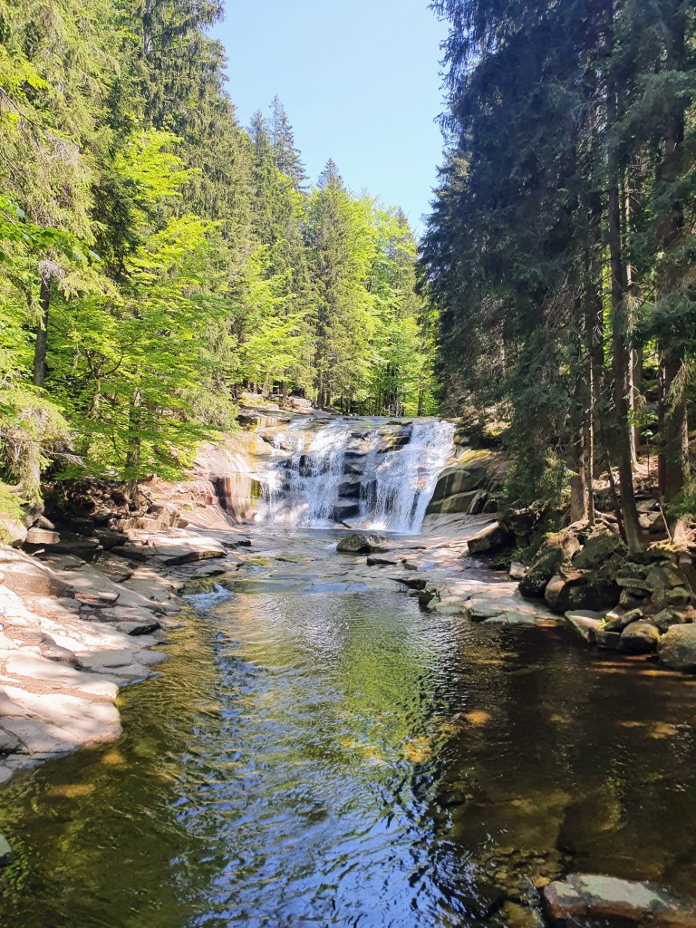
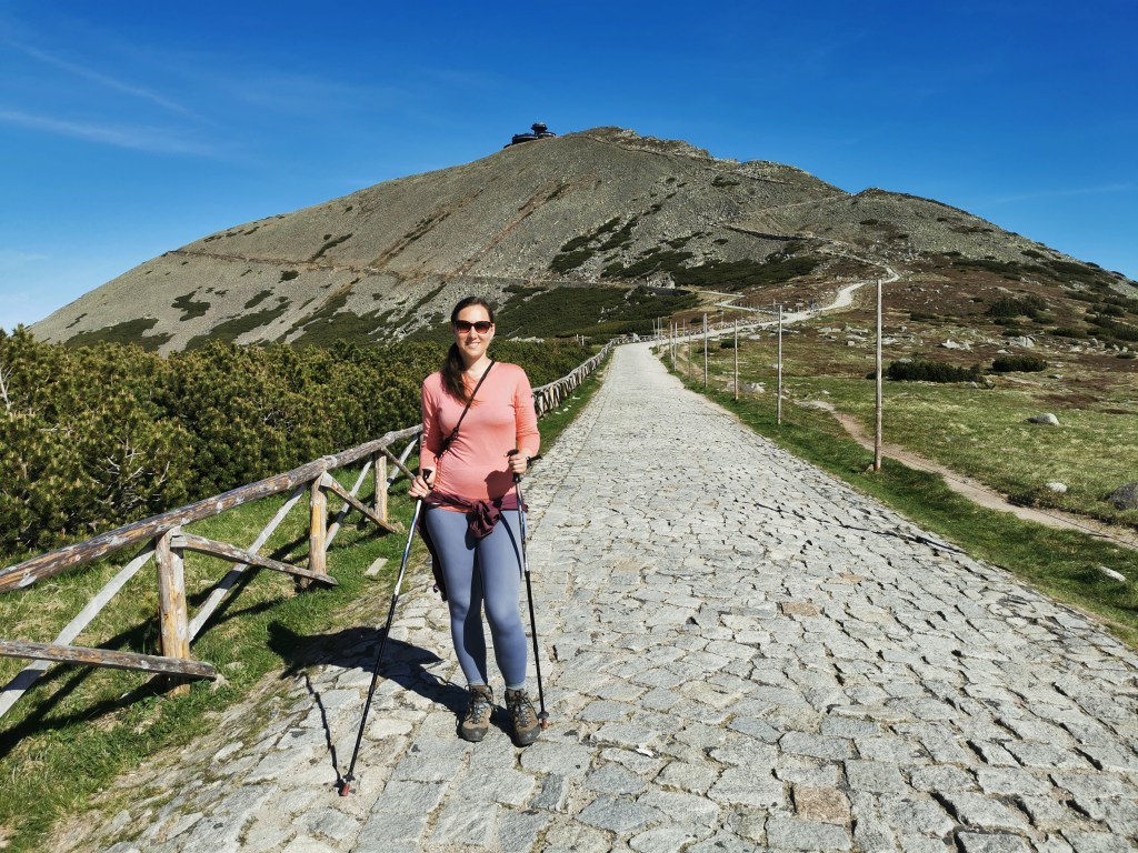
After all of this, it was finally time to start the hike! From the restaurant, you just go past the bus station and keep to the left, following the smaller of the two roads. A bit further you will cross a small bridge and you are already amongst the trees. You can keep going on this main trail or branch off to the right to take the smaller path, as they both end up at the first point of note, Mumlavský vodopád. This pretty waterfall can be viewed from a little wooden bridge over the river or by walking along the edge of the water to sit by the plunge pool and admire it. Given that it is only a kilometre or so from Harrachov, it is a very popular place to visit, even for people who are not intending to walk any further. We sat for a while by the water and there was a constant stream of people coming to have a look. I can’t imagine how busy it would be during peak season. We stayed for a while before moving back to the main trail.
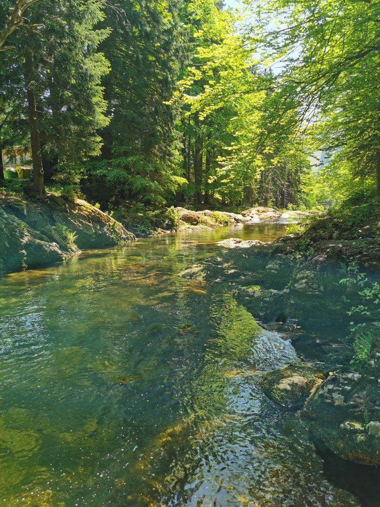
The path carries on through the forest following the Mumlava river. Every now and again a lovely cascade or pool would open up in front of you. Despite the clear blue sky, the shade provided by the trees meant it stayed a nice temperature to walk in.
You keep on the path through the trees for another few kilometres, making sure that you do not cross over the river at the bridge just before Krakonošova Snídaně (or Ruebezahl’s Breakfast). If you’re using google maps then it will only show the path over the bridge. Downloading this area of the Czech Republic onto maps.me prior to your hike would be much more useful; or if you don’t mind navigating a bit of Czech, Radka uses the app mapy.cz, which has the best coverage of the different trails.
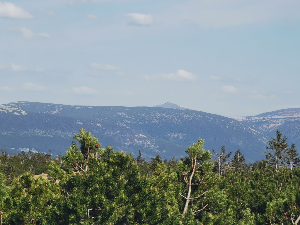
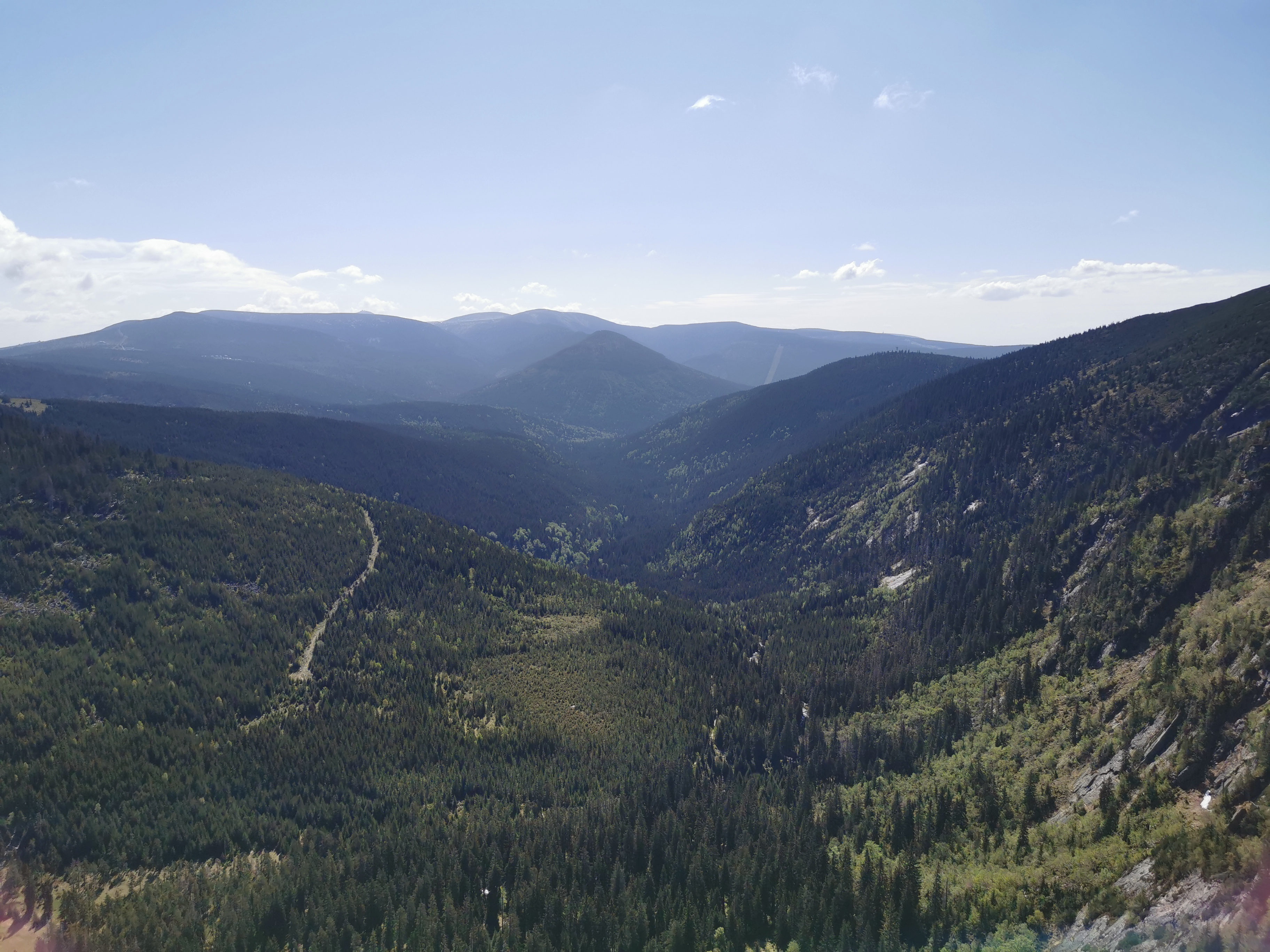
It’s not too long after this point that you start walking up steeper paths as you head towards the tops of the hills. To be honest, this change of track was welcomed as the route was becoming a little bit monotonous. Once you reach the top of the hills the path flattens out again and the surroundings become a lot different. Instead of the usual trees that have lined the route so far, the path is bordered by rows of small pines. Their size means that you can now also see the rolling hills around you and once you’ve carried along the path for a while, you get your first glimpse of Sněžka poking up over the intervening hills. Sněžka is the highest mountain in the Czech Republic and hiking to it and climbing it was the ultimate aim of our trip.
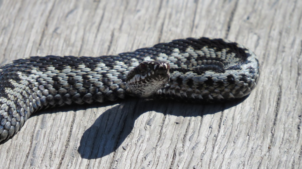
The view of Sněžka came just before reaching the end of the pine trees and where our path met another major track cutting straight across it. Also just before this point, we had our first adder encounter. Despite having adders in the UK, I’d never seen one, so it was quite surreal to see it shoot away off the path and into the foliage. And yes I did say first encounter…
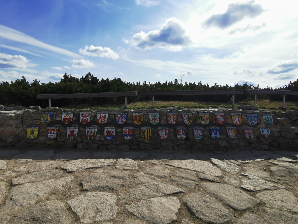
We turned left at the intersection of the paths and carried on walking. There was another path that led directly to our end point for the day, Labská Bouda, but we decided to add one final point to our itinerary by taking the path heading straight up the hill. At the end of this track is the source of the Labe river (Pramen Labe). On the wall at the site is a series of 28 plaques that show the crests of the major cities that the Labe (also known as the Elbe river) flows through on its way through the Czech Republic and Germany before finishing its journey at the North Sea.
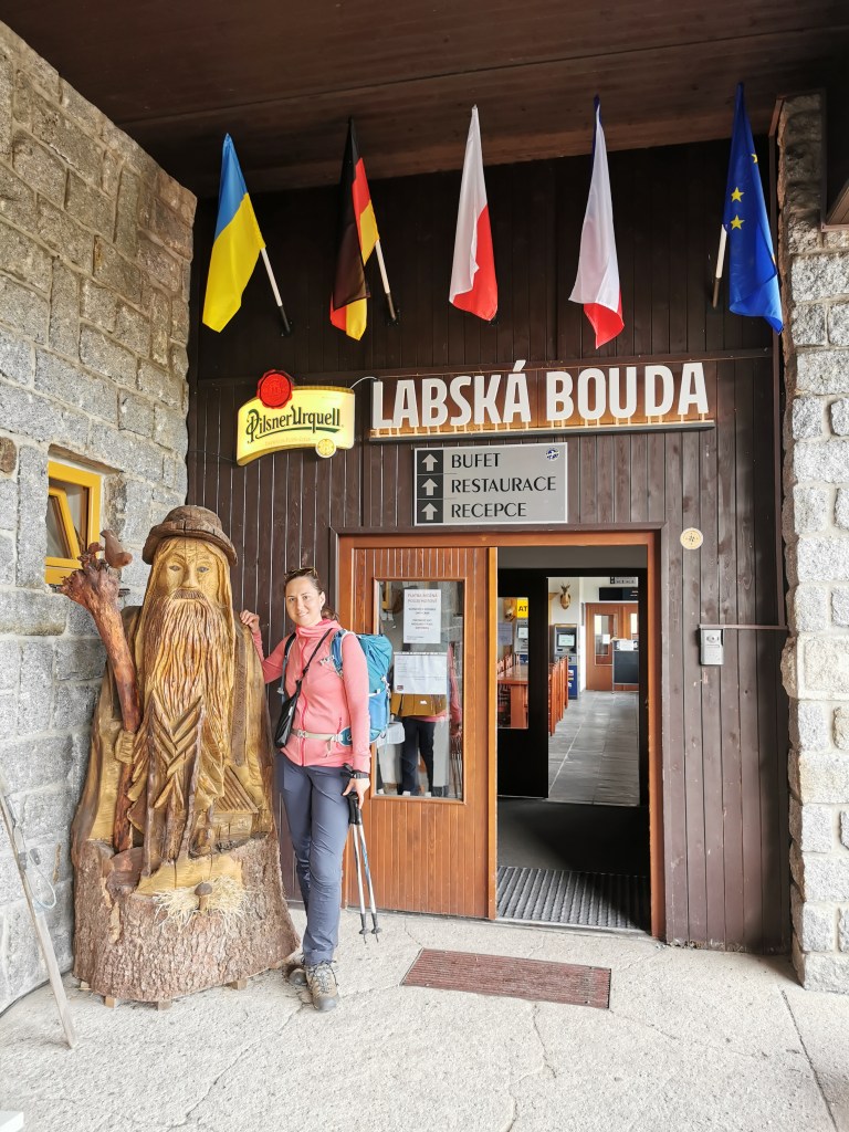
From here is was only a short walk to our accommodation for the night, Labská Bouda. It was very clear from the architecture that the hotel was built during the communist era but by looking at the photos inside the entrance, it replaced a much prettier alpine-style inn that had burnt down in the 1960s. At the entrance was also a wooden statue of Krakonoš. This legendary giant is the guardian of the mountains and from hearing the legends, is not someone to which you’d want to get on the wrong side.
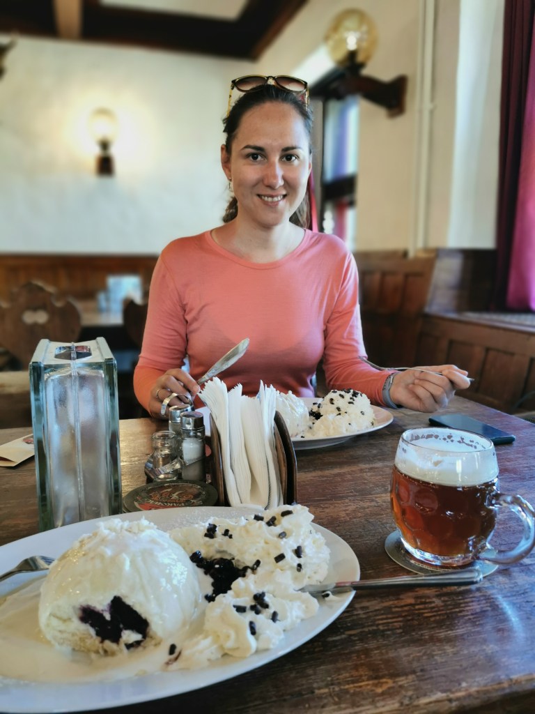
Despite the huge nature of the hotel, only two of the rooms were occupied (including ours) so we got our pick of the seats at the restaurant, where we could relax and enjoy another traditional meal. It was my turn to have the Svíčková and dumplings, whilst Radka had lívance s borůvkami (pancakes with blueberries). This really finished off a lovely first day in the mountains.
By the way, if anyone is interested in using the Relive app, I’d appreciate if you went through the following link. Just so you are aware I do potentially get money off my subscription if I get other people to subscribe and you would get a free month of the pro version of the app. So it would be a win-win!
Day 2 – Labská Bouda to Brádlerovy Boudy
The advantage of having a bit of local knowledge is that we could be more flexible in the path that we chose. This led to Radka adding a loop onto our route to incorporate some lovely scenery and areas of historical importance that is not part of the official Czech Trail.
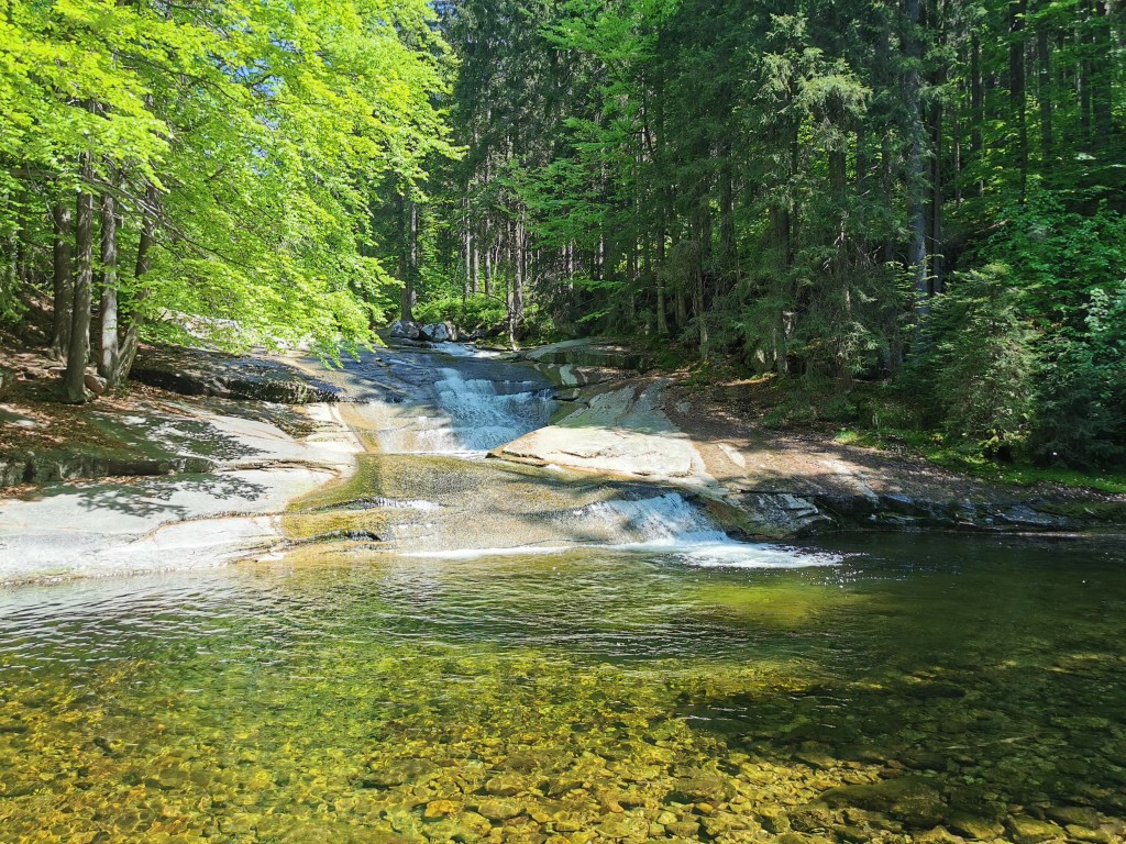
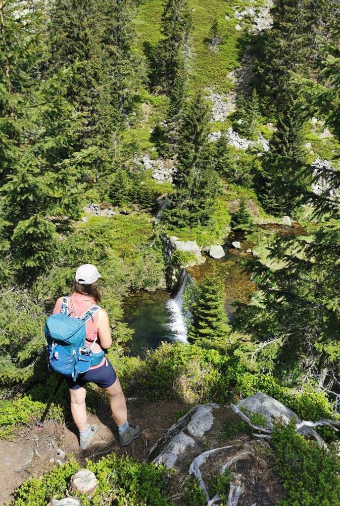
We got up pretty early to enjoy a large breakfast before heading out into the crisp morning air. The loop that we were going to do is actually a popular day hike that comes up from Špindlerův Mlýn, but because we were starting from the point in the hills rather than the town, it meant that for the first stretch we had the place all to ourselves. There was a lovely view over the valley and the surrounding heights, which would make up the majority of the day’s walking. It wasn’t long before we reached the top of Pancavsky vodopad, a picturesque waterfall where the small stream slowly made its way to the rocky lip before plummeting down to the valley floor below. Given its popularity and how beautiful a day it was, Radka just couldn’t believe that we were the only ones there. It was a nice place to pause and enjoy the tranquility, but given that we still had a long way to go we couldn’t stay for too long.
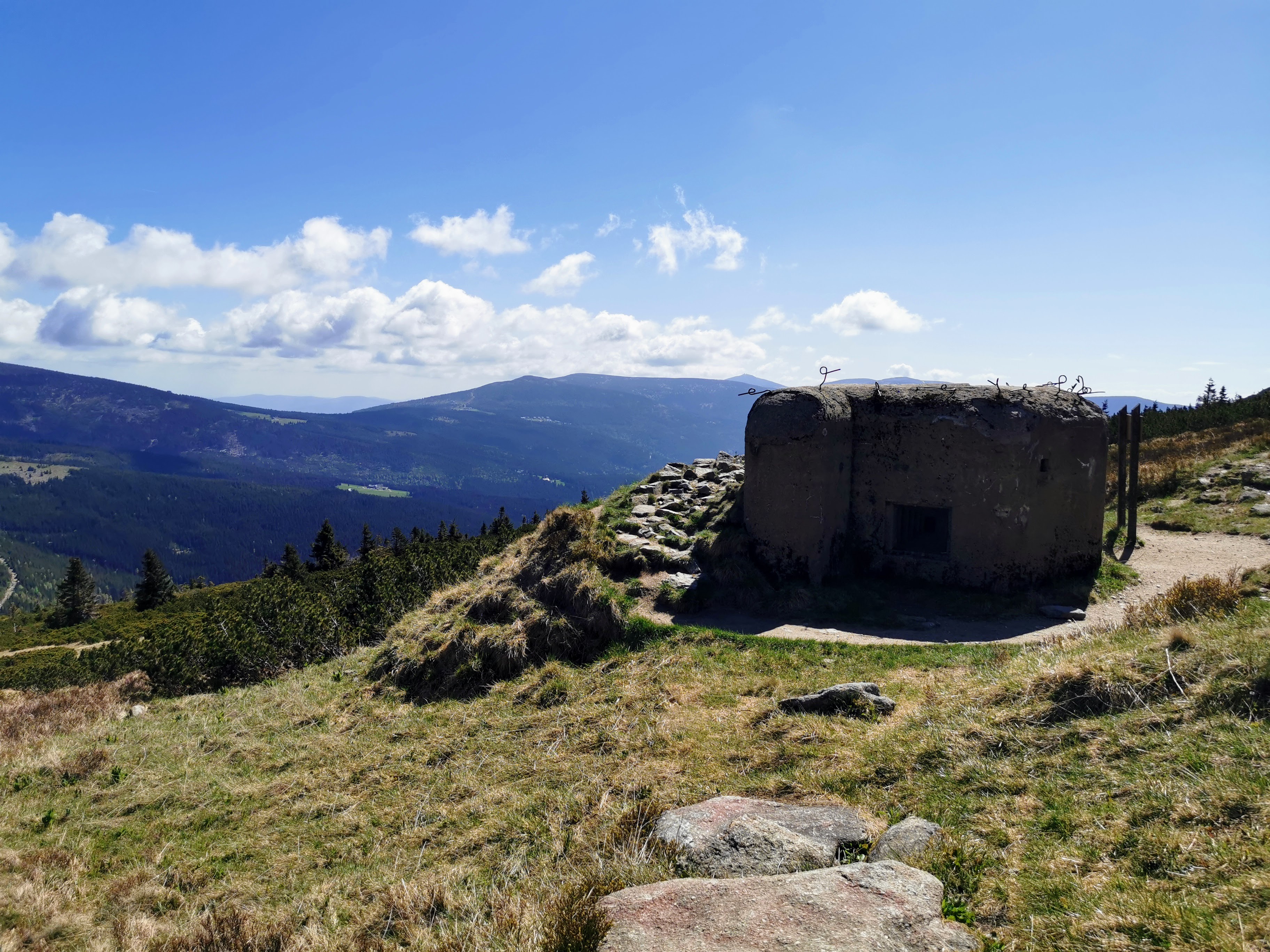
After continuing the scenic walk along the top of the ridge, we came across some old concrete bunkers. These fortifications were built in the 1930s as a precaution against the rise of Nazi Germany. The idea was to strengthen the borders with Germany, Poland and Hungary. Despite many of the bunkers being completed in very swift time, the progress was made moot by the Munich Agreement. Despite not having any representatives from Czechoslovakia present, the leaders of France, Italy and the UK agreed to give Germany part of Czechoslovakia in an act of attempted appeasement of Hitler. Losing this area meant Czechoslovakia lost its natural protective border along with its recently strengthened defensive fortifications. Lots of heavy industry was also present in the ceded lands, meaning that when Hitler reneged on his promise to halt any further attempts at expansion, Czechoslovakia was powerless to prevent Germany taking the rest of the country.
Many of the smaller bunkers are still to be found dotted amongst the hills, and it was interesting to have a look inside and imagine what it must have been like at the time.
We hadn’t walked much further when we came across another couple of monuments. It marked the points where two friends sadly lost their lives during a famous international cross-country ski race in 1913. When the weather drastically changed for the worst, one of the skiers, Bohumil Hanc, became stranded. One of his supporters, Vaclav Vrbata, set out to find him, and despite managing to locate his friend, neither of them were able to make it back to safety, despite the Bouda only being a few kilometres away.
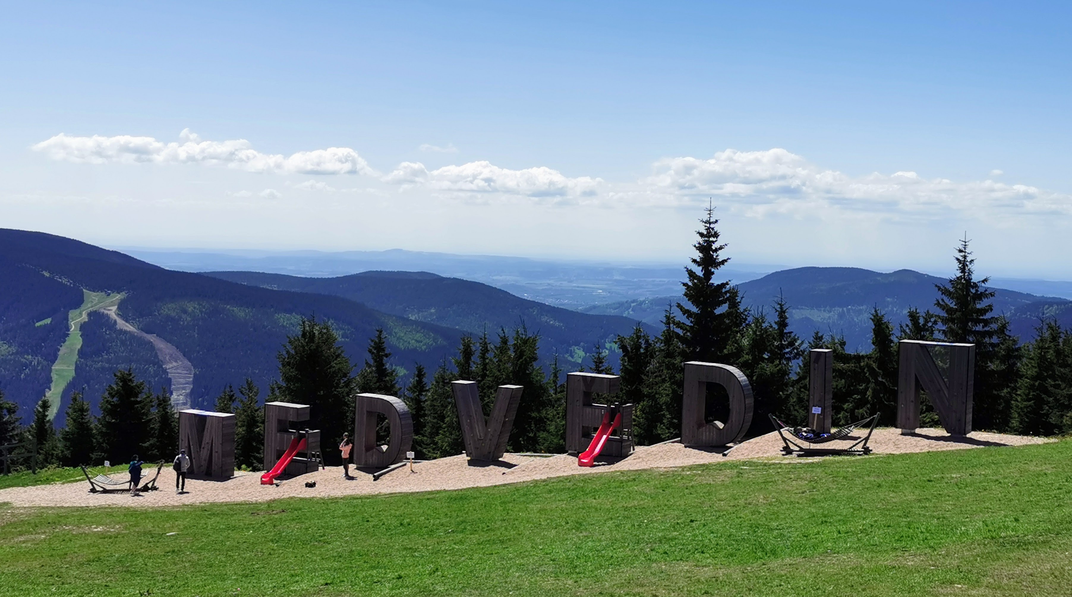
From the monument, you follow the road down for a while before heading back onto a track into the forest. The track is pleasant and incorporates a walk for children with some statues and information points.At the end you reach the top of Medvědín. This complex is part of the ski resort during the winter, but during the warmer months it is an access point to the mountains from the town of Špindlerův Mlýn below. At this time, we had to decide whether to walk down to the town or take the chairlift. We didn’t think there was anything to gain by walking down so we instead relaxed and ordered a strudel and beer from the restaurant whilst we waited for the chairlift to become operational again after the lunch break. It was definitely not a decision we regretted, despite the chairlift ending up being quite expensive for what it is.
The views from the chairlift were nice and it took us down to the outskirts of Špindlerův Mlýn. Our route, however, did not take us through the town – we instead turned left from the exit from the station and started following the river back amongst the trees. The river was the Labe, the same river to which we had visited the source the day before. The path along its bank was quite peaceful, despite it being so close to the town, and the shade allowed us to avoid the worst of the afternoon sun.
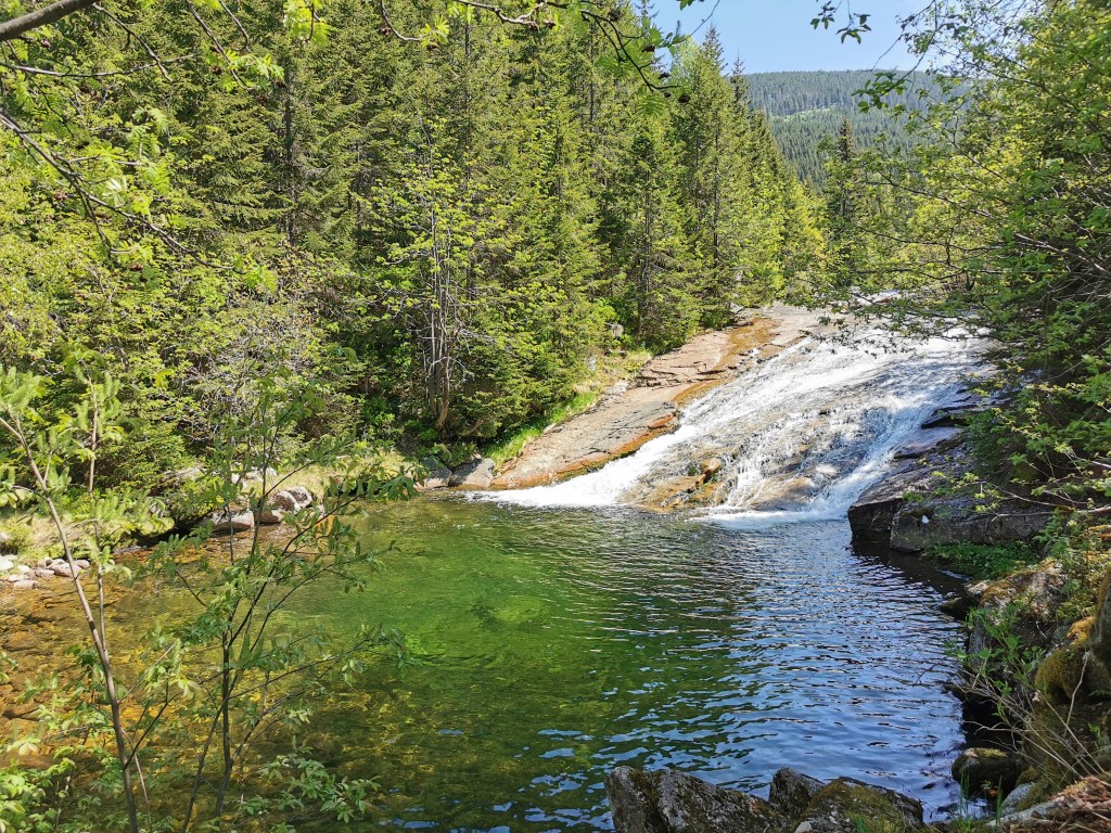
We walked for about an hour and a half before reaching the beautiful spot of Malý Labský vodopád. We decided that this would make a perfect lunch spot, so we sat on the rocks and listened to the sounds of the river as we ate our sandwiches.

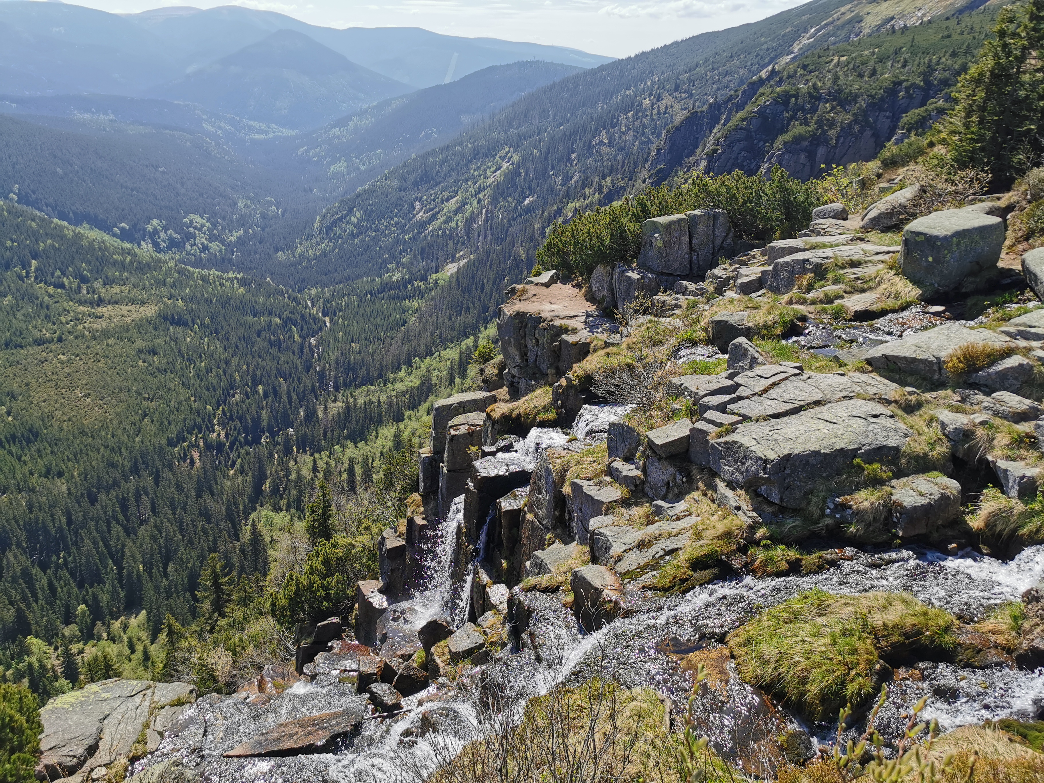
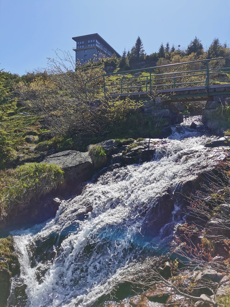
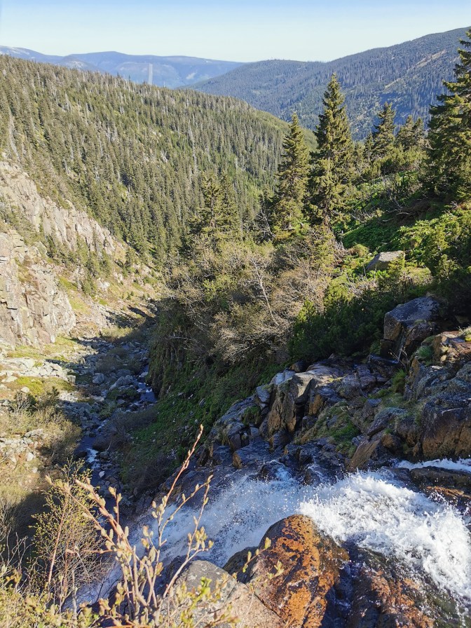
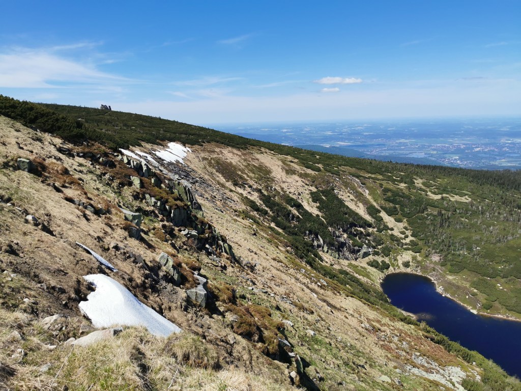
We followed the river deeper into the valley for another hour and a half before we spotted the Pancavsky vodopad snaking its way down the far side of the valley. It was nice to have seen it from the top in the morning and then from the bottom in the afternoon. It wasn’t long after this that the path starting getting a lot steeper, as started the climb back up towards Labská Bouda. After climbing up for another hour or so, we stopped at a point near the top where a wooden walkway had been constructed to overlook Labský vodopád and the steep descent of the river into the valley below.
We were sat on the rocks to the side of the wooden viewpoint when Radka suddenly yelled and moved backwards. To her right, only a metre or two away, an adder had slithered up between the wooden boards and was now stretched upright flicking its tongue at us. After we’d backed up it calmed down and moved away into the grass but we were left in a bit of shock – having never seen an adder it was now two in two days!
Despite the fact that the loop we had just completed was a common day hike, we were not actually that close to our hut for the night. So we headed off in the opposite direction to Labská Bouda, and up towards the Polish border. It wasn’t long before we were back amongst the sparse, short pine trees as we made our way towards RTON Śnieżne Kotły, a radio and television broadcasting centre that was built in 1897 as a mountain shelter. Just before we reached it, we crossed into Poland.

It was then time to join part of the Czech-Polish Friendship Trail, which crosses the Krkonoše mountains along the Czech-Polish border. By this time, the sun was starting to dip and the temperature was following suit, not helped by the wind coming in from the north. So we layered-up and walked around Sněžné jámy – the Snow Pots. These interesting rock formations are in the cliffs on the Polish side of the border, and are famous for having rare flora. We didn’t really notice the plants, however, not when there were amazing views down and across the plains into Poland.
We followed the trail for a while in Poland before it looped back around into the Czech Republic, and towards over accommodation for the evening – Brádlerovy Boudy.
It had been a long day and, as amazing as it had been, we were shattered and very happy when we finally viewed the bouda. You can imagine our frustration therefore, when we got inside and were greeted with dozens of young kids on a school trip. It also meant that they were not doing the usual menu due to the necessity of providing food for all of the students. So whilst the meal felt a little like being back in school dinners, we were still grateful to be able to get anything at that time and once the kids had gone to their rooms, we were able to get a couple of dark Czech beers and relax. So it still turned out to be a nice ending to a fantastic day.
Remember, if you would like to try the Relive app, I’d appreciate it if you could use the following link:
Day 3 – Brádlerovy Boudy to Luční Bouda, via Sněžka
We woke up to another beautiful day. We had to dodge the multitude of students to get breakfast but then we were able to escape into the peace and tranquility of the forest.
The first part of the days hike was a nice walk up the hill and into the trees on a small forest trail. It wasn’t long before we came across the first of several interesting rock formations that we would see on our third day. We climbed up and were rewarded with lovely views, including looking down to where we had stayed in Brádlerovy Boudy.

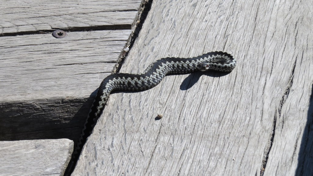
It was not far after this that another adder quickly darted across the path just in front of us, but it was no longer such a shock at this point. After leaving this part of the forest, the path now exactly followed the Czech-Polish border for a stretch and what was really interesting was the density of the trees on either side of the path. Apparently during the 1970s there was an issue with acidic rain killing trees in the area. The Czechoslovak approach was to remove all of the dead trees entirely and plant new ones. The Polish approach was to leave the dead trees there to rot, and thus let the forest recover naturally. The Polish approach has now led to a much healthier forest, and the results are visible, even to the untrained eye. At the end of the path is another popular hotel, Špindlerova Bouda, but we did not stop there, and instead carried along the path and up the hill.
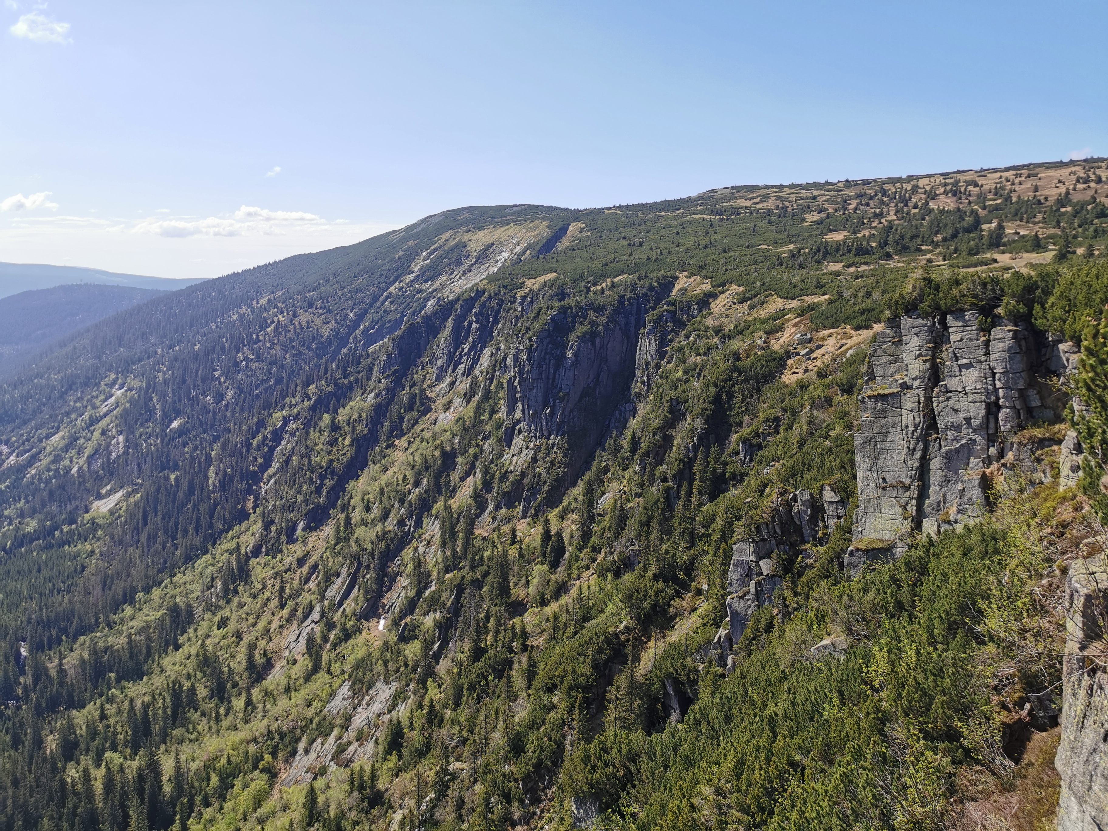
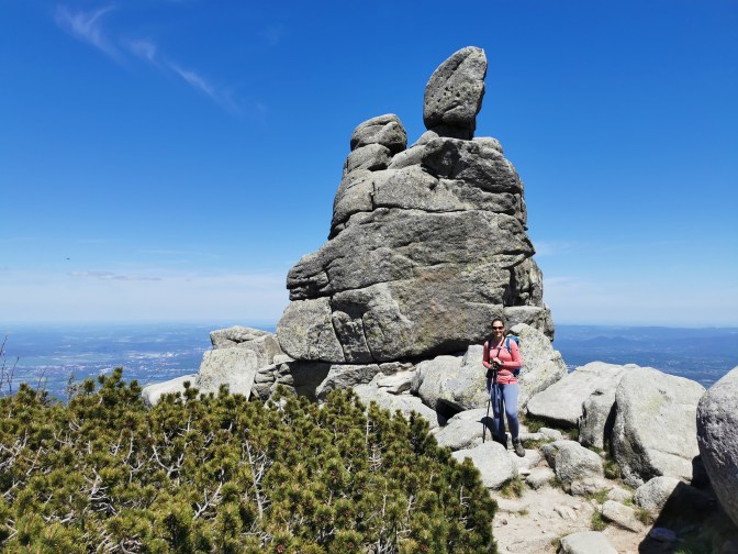
The path again followed the ridge that separated the Czech Republic from Poland and contained beautiful, sweeping views of the lowlands below. Not too far along this track are the Słonecznik rock formations. These impressive granite pillars seem to come from no-where are in total contrast to the gentle slopes that surround them. They were an excellent place to stop for lunch!

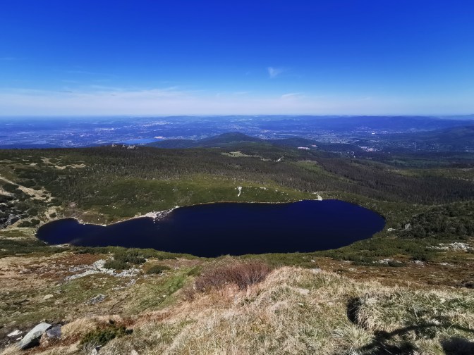
Another fifteen minutes or so of walking, and we had beautiful views of the deep blue Wielki Staw lake.
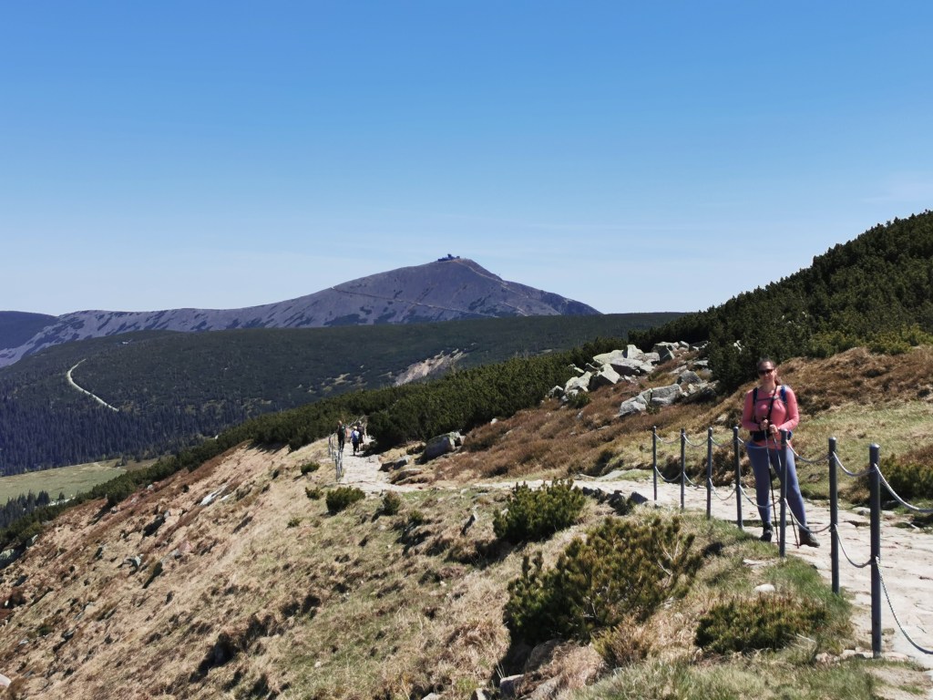
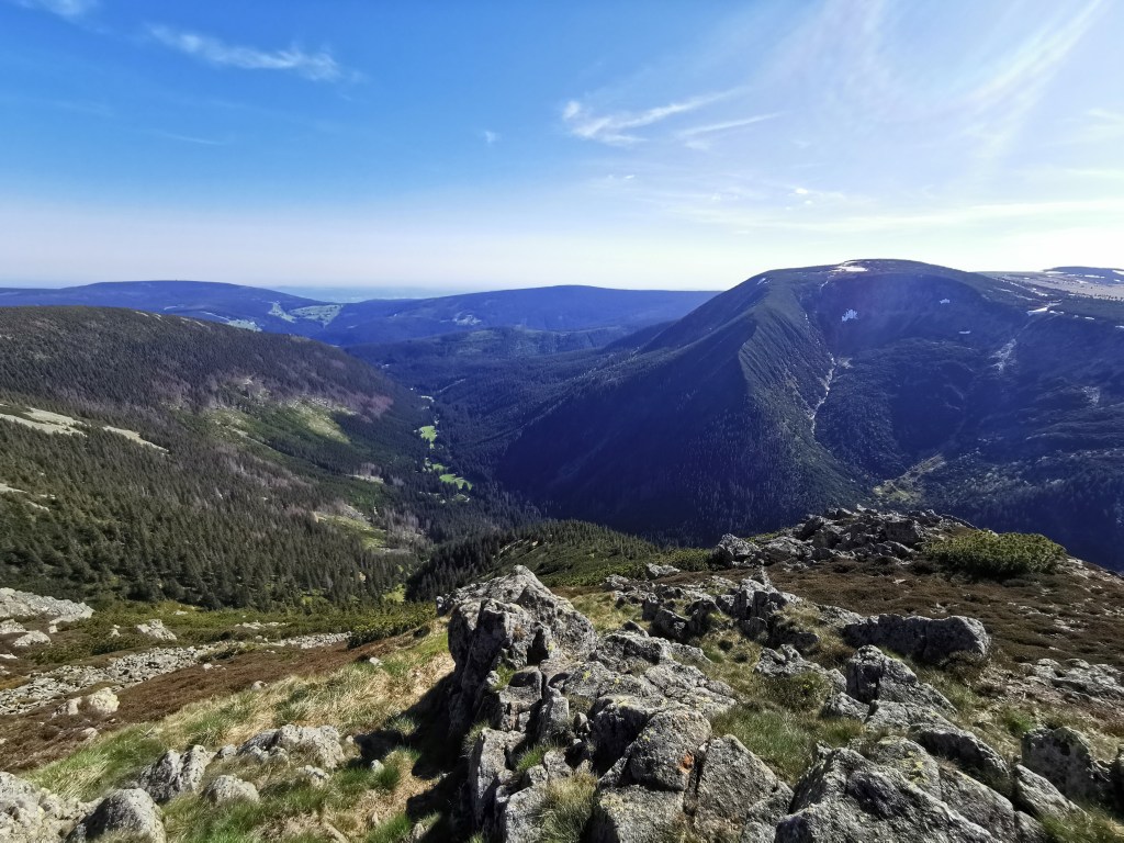
It was at this point that we also started to get excellent views of Sněžka dominating the horizon in front of us.
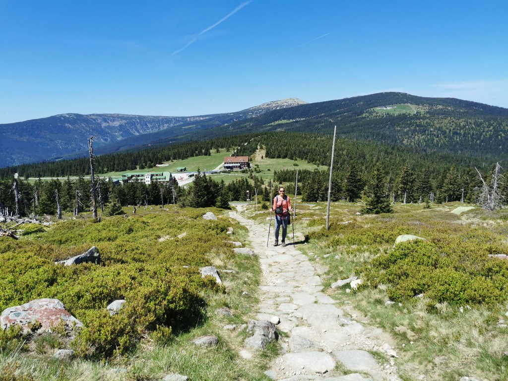
Less than an hour of walking later and we had reached Luční Bouda, our accommodation for that evening. It was still early afternoon, and we were not yet done with walking for the day, but we waited until we could check into our room and spent the time having a late lunch. This time we both enjoyed blueberry dumplings and washed them down with another speciality Czech beer.
The plan was to climb Sněžka in time for sunrise the following morning, but we wanted to scout out the route in the daylight first. So, once we had managed to check into our room, we set off to climb the highest mountain in the Czech Republic.
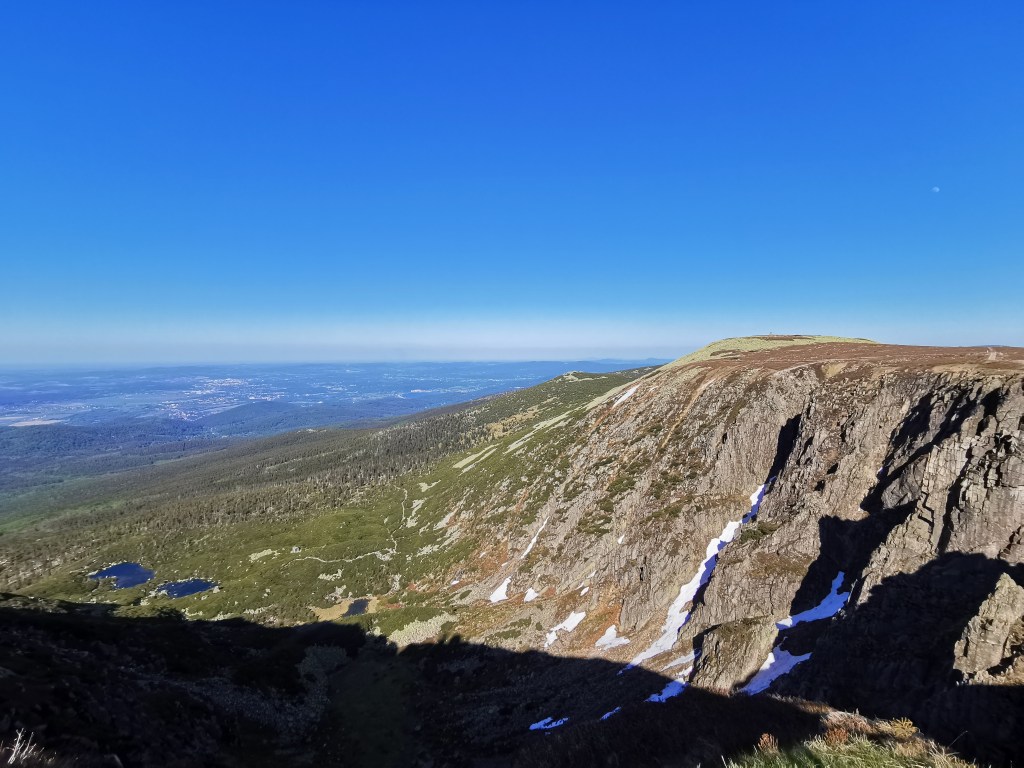
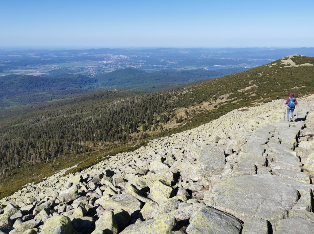
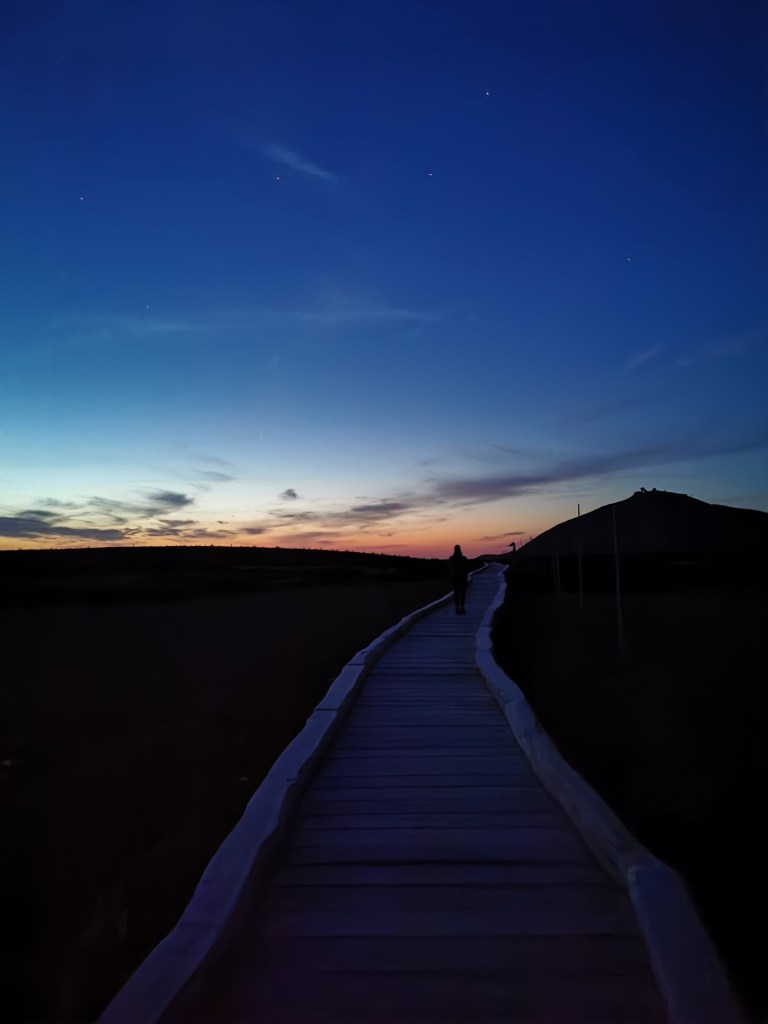
The main start of the ascent was still thirty mins to an hour away over fairly flat terrain, and involved a wooden walkway for part of it, in an attempt to protect the meadow ecosystem. So it was a pleasant stroll to get to Dom Śląski Schronisko Górskie, another mountain hotel that is right at the start of the ascent. Well at least the start of the ascent from the direction we arrived from. Lots of people who come to climb Sněžka do so from the bottom of the valleys either side, and thus make it into a much tougher climb. For us, whilst it was steep, it was not very far and we quickly made progress up the slope. It is worth noting that there are two ways up to the summit. There is the path we took, which is rockier and steeper, but there is also a road that winds around the back. We decided to take the more mountainous path up and then the more gentle, but longer, road back down.

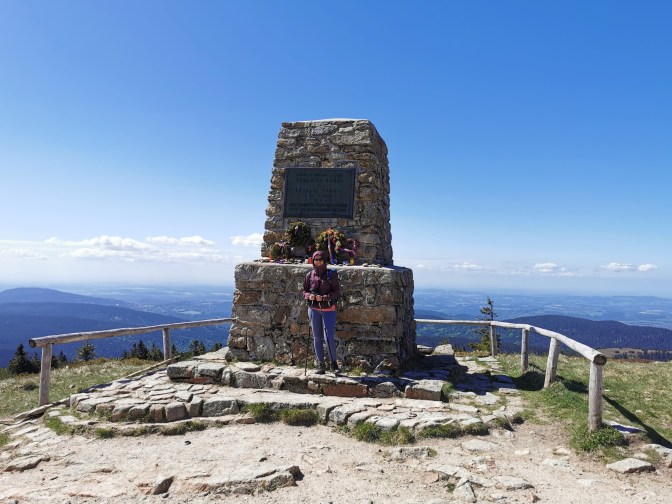
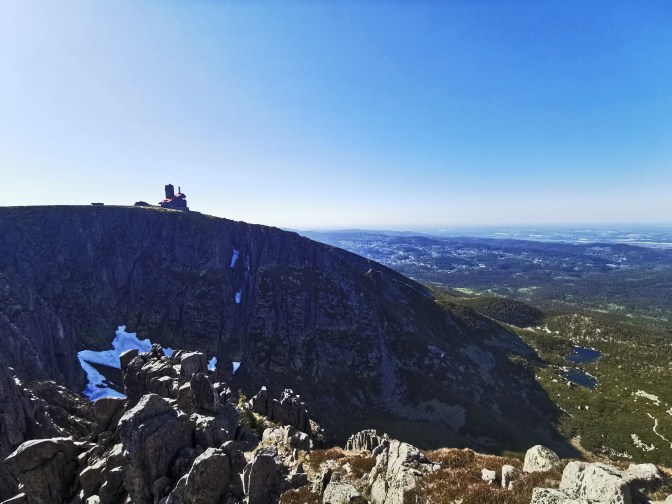
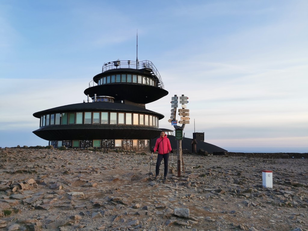
The peak itself is interesting rather than spectacular with several strangely constructed buildings, including a post office and an observatory, but neither were open when we got there (it was quite late at this point). The post office is supposed to have a little shop where you can get snacks as well, but we couldn’t confirm it. What is quite cool is that the border runs right over the top of the mountain, with markers showing you the exact position. The views around are also very nice, with the Polish plains on one side and Czech valleys on the other.
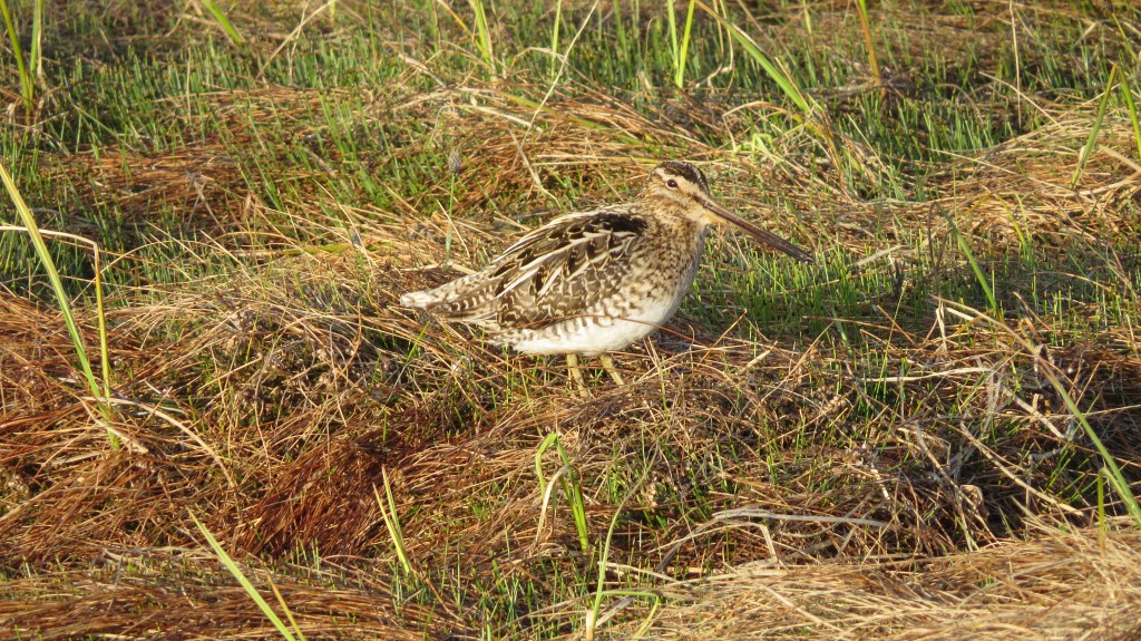
After spending some time at the top, it was time to head back to Luční Bouda. Apart from taking the road down rather than the path, it was the same route back that we had taken earlier. It was quite late in the afternoon by this point but we still had time to watch some birds in the meadows on the way back, catch the beautiful sunset, and spend some time relaxing in the hotel sauna before getting some sleep in preparation for our early start. It had been another beautiful day.

Day 4 – Luční Bouda to Špindlerův Mlýn, via Sněžka (again…)
Getting up to the top of Sněžka for sunrise meant waking up stupidly early, but what didn’t help (or did help depending on your perspective) was that another group in the hotel had the same idea but very noisily left half an hour before our alarms were set to go off. Some of their members were obviously drunk, so we guess they just hadn’t slept. So when we left a while later, we weren’t feeling at our most spritely!
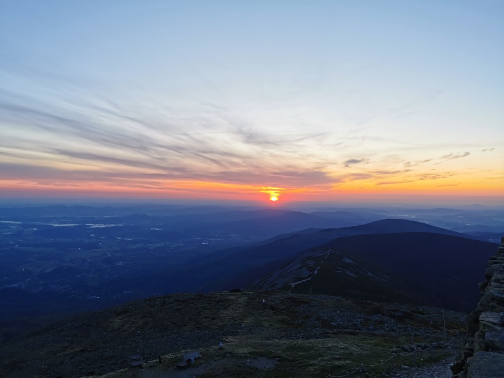
We were glad we had checked out our route the previous day, as it meant that we didn’t need to worry about finding any turns with just our head torches. So we could just walk quietly in the early morning stillness. As we made our way towards the mountain, the sky got its first hint of colour, and this intensified as we got to the base.
Despite the sky starting to colour, it was still quite dark underfoot, so we took the flatter, easier road to get to the summit. And despite being a bit worried that we’d messed up the timings, we ended up comfortably making the top before the sun peaked out across the horizon. It was another beautiful morning and an amazing place to watch the sunrise. And if you are wondering – the drunken group from the hotel also made it, with fresh cans in hand.
After the main event, we still stayed around for a while longer to enjoy the views before heading back to the hotel for breakfast.
After enjoying the well-earned breakfast and checking out of the hotel, it was time to do the final part of the trek. Until this moment, we were still not 100% sure where we were going to go. We could have carried on in the direction of Sněžka and walked down into the valley, but after looking at the possible routes and checking buses, we decided to walk down to Špindlerův Mlýn.
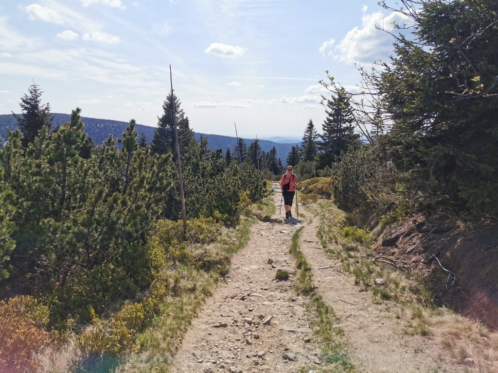
The first part of the walk involved walking across the fairly flat plateau on top of the hills, where Luční Bouda was situated. Despite this being in the general direction that we had come from the day before, it was a different route with different scenery. This walk was very pleasant but improved further when we turned and started descending into the valley that would take us to our destination. The valley was more green and we were back to following a pretty river, which was broken up by a number of small waterfalls and cascades.

The route carried on in much the same vein, sometimes on narrow forest tracks, sometimes on wider paths that were also used by cyclists.

The path ended up joining the route along the river that we had taken in the opposite direction two days prior. So we ended up passing the cablecar station again (and remembering that they had public toilets…) before heading into Špindlerův Mlýn. The town is very nice and has an ‘upmarket alpine tourist vibe’, but is also very expensive for Czech Republic. But, we were able to stretch to buying a couple of ice-coffees to celebrate the end of our hike before heading to the bus stop on the main road (295) a bit along from the bridge over the Labe. The bus was on time and we were able to relax for our journey back to Prague.
Final thoughts
We thoroughly enjoyed our time in the Krkonoše National Park, both on the Via Czechia route and our detours. The ‘Giant’s Mountains’ possess a fantastic variety of terrain, from pleasant forests with picturesque rivers and waterfalls, to sweeping plateaus and craggy peaks. The pathways were also well maintained and generally very easy to follow. What also made our trip easier was that there was an abundance of accommodations, so you were never too far away from somewhere that could provide a hot meal. Whilst some people might feel that this has taken away from the wildness of the natural setting, I was happy to experience this part of Czech culture and thoroughly enjoyed the mountain hotels and traditional meals. Going out of season also helped with being a bit more flexible in terms of booking the accommodation. Of course one other thing that made the trip so amazing was how unbelievably lucky we had been with the weather! So whilst I cannot promise the same if you visit, I’d definitely recommend exploring this beautiful section of the Czech Republic if you ever get the chance.
